You are here: Home > Network List > TA - USArray Transportable Network (new EarthScope stations) Stations List
> Station K40A Colesburg, IA, USA > Earthquake Result Viewer
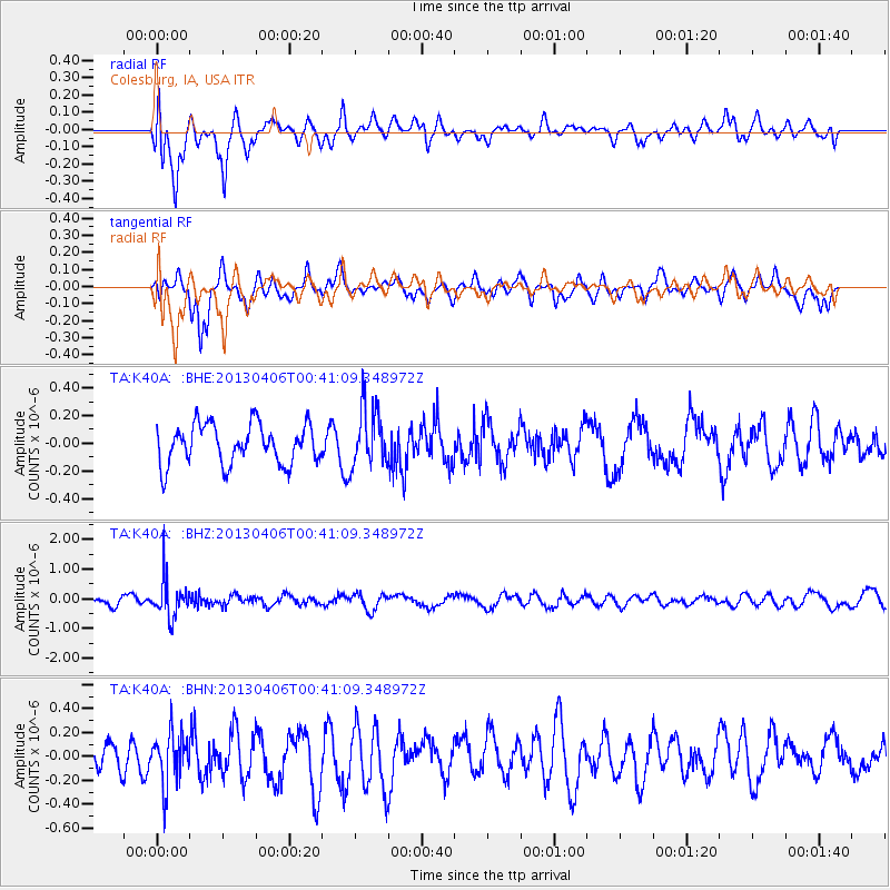
K40A Colesburg, IA, USA - Earthquake Result Viewer
*The percent match for this event was below the threshold and hence no stack was calculated.
| Earthquake location: |
E. Russia-N.E. China Border Reg. |
| Earthquake latitude/longitude: |
42.7/131.0 |
| Earthquake time(UTC): |
2013/04/06 (096) 00:29:55 GMT |
| Earthquake Depth: |
563 km |
| Earthquake Magnitude: |
5.8 MW, 5.5 MB, 5.9 MW |
| Earthquake Catalog/Contributor: |
NEIC PDE/NEIC PDE-W |
|
| Network: |
TA USArray Transportable Network (new EarthScope stations) |
| Station: |
K40A Colesburg, IA, USA |
| Lat/Lon: |
42.70 N/91.14 W |
| Elevation: |
274 m |
|
| Distance: |
86.9 deg |
| Az: |
29.675 deg |
| Baz: |
330.339 deg |
| Ray Param: |
$rayparam |
*The percent match for this event was below the threshold and hence was not used in the summary stack. |
|
| Radial Match: |
55.485367 % |
| Radial Bump: |
400 |
| Transverse Match: |
56.436268 % |
| Transverse Bump: |
400 |
| SOD ConfigId: |
512894 |
| Insert Time: |
2013-09-13 01:49:20.921 +0000 |
| GWidth: |
2.5 |
| Max Bumps: |
400 |
| Tol: |
0.001 |
|
Signal To Noise
| Channel | StoN | STA | LTA |
| TA:K40A: :BHZ:20130406T00:41:09.348972Z | 4.348015 | 6.5356596E-7 | 1.5031364E-7 |
| TA:K40A: :BHN:20130406T00:41:09.348972Z | 1.5958036 | 2.2203177E-7 | 1.3913477E-7 |
| TA:K40A: :BHE:20130406T00:41:09.348972Z | 1.5122063 | 2.1741131E-7 | 1.4377093E-7 |
| Arrivals |
| Ps | |
| PpPs | |
| PsPs/PpSs | |


