You are here: Home > Network List > US - United States National Seismic Network Stations List
> Station MSO Missoula, Montana, USA > Earthquake Result Viewer
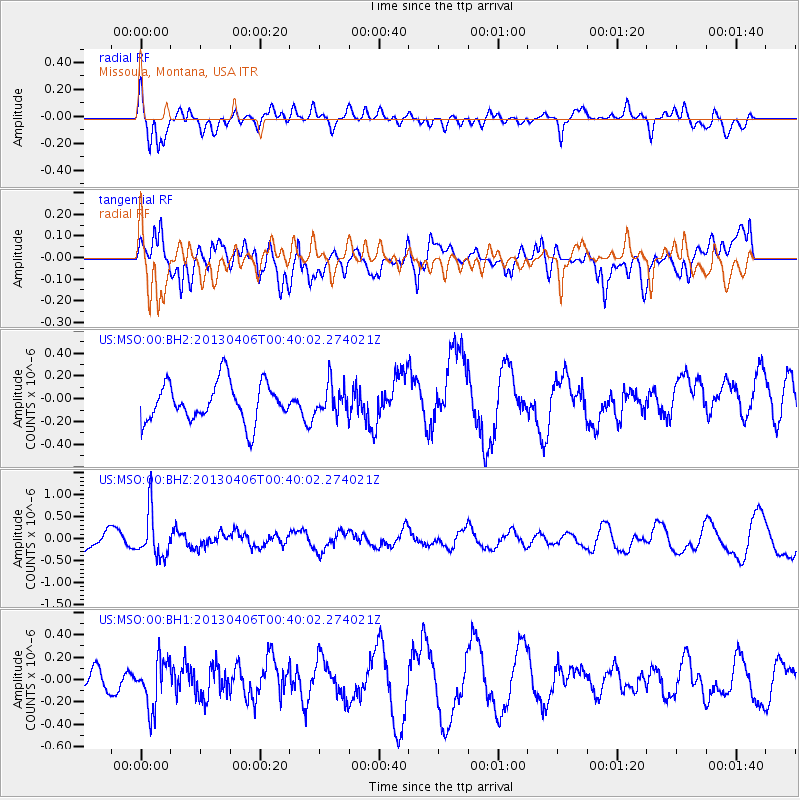
MSO Missoula, Montana, USA - Earthquake Result Viewer
*The percent match for this event was below the threshold and hence no stack was calculated.
| Earthquake location: |
E. Russia-N.E. China Border Reg. |
| Earthquake latitude/longitude: |
42.7/131.0 |
| Earthquake time(UTC): |
2013/04/06 (096) 00:29:55 GMT |
| Earthquake Depth: |
563 km |
| Earthquake Magnitude: |
5.8 MW, 5.5 MB, 5.9 MW |
| Earthquake Catalog/Contributor: |
NEIC PDE/NEIC PDE-W |
|
| Network: |
US United States National Seismic Network |
| Station: |
MSO Missoula, Montana, USA |
| Lat/Lon: |
46.83 N/113.94 W |
| Elevation: |
1264 m |
|
| Distance: |
73.9 deg |
| Az: |
40.33 deg |
| Baz: |
316.008 deg |
| Ray Param: |
$rayparam |
*The percent match for this event was below the threshold and hence was not used in the summary stack. |
|
| Radial Match: |
70.83523 % |
| Radial Bump: |
400 |
| Transverse Match: |
53.335278 % |
| Transverse Bump: |
400 |
| SOD ConfigId: |
512894 |
| Insert Time: |
2013-09-13 02:01:40.782 +0000 |
| GWidth: |
2.5 |
| Max Bumps: |
400 |
| Tol: |
0.001 |
|
Signal To Noise
| Channel | StoN | STA | LTA |
| US:MSO:00:BHZ:20130406T00:40:02.274021Z | 2.2954621 | 5.170896E-7 | 2.2526602E-7 |
| US:MSO:00:BH1:20130406T00:40:02.274021Z | 1.7770131 | 2.1768858E-7 | 1.2250251E-7 |
| US:MSO:00:BH2:20130406T00:40:02.274021Z | 0.75724673 | 1.3020103E-7 | 1.7194004E-7 |
| Arrivals |
| Ps | |
| PpPs | |
| PsPs/PpSs | |


