You are here: Home > Network List > UW - Pacific Northwest Regional Seismic Network Stations List
> Station UMAT Pilot Rock, OR, USA > Earthquake Result Viewer
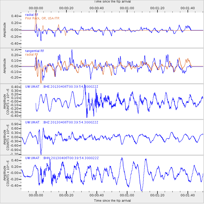
UMAT Pilot Rock, OR, USA - Earthquake Result Viewer
*The percent match for this event was below the threshold and hence no stack was calculated.
| Earthquake location: |
E. Russia-N.E. China Border Reg. |
| Earthquake latitude/longitude: |
42.7/131.0 |
| Earthquake time(UTC): |
2013/04/06 (096) 00:29:55 GMT |
| Earthquake Depth: |
563 km |
| Earthquake Magnitude: |
5.8 MW, 5.5 MB, 5.9 MW |
| Earthquake Catalog/Contributor: |
NEIC PDE/NEIC PDE-W |
|
| Network: |
UW Pacific Northwest Regional Seismic Network |
| Station: |
UMAT Pilot Rock, OR, USA |
| Lat/Lon: |
45.29 N/118.96 W |
| Elevation: |
1318 m |
|
| Distance: |
72.5 deg |
| Az: |
44.04 deg |
| Baz: |
313.476 deg |
| Ray Param: |
$rayparam |
*The percent match for this event was below the threshold and hence was not used in the summary stack. |
|
| Radial Match: |
38.07097 % |
| Radial Bump: |
400 |
| Transverse Match: |
67.56928 % |
| Transverse Bump: |
381 |
| SOD ConfigId: |
512894 |
| Insert Time: |
2013-09-13 02:05:32.712 +0000 |
| GWidth: |
2.5 |
| Max Bumps: |
400 |
| Tol: |
0.001 |
|
Signal To Noise
| Channel | StoN | STA | LTA |
| UW:UMAT: :BHZ:20130406T00:39:54.300022Z | 2.0372038 | 4.8974965E-7 | 2.404029E-7 |
| UW:UMAT: :BHN:20130406T00:39:54.300022Z | 1.8926197 | 2.2183384E-7 | 1.1720994E-7 |
| UW:UMAT: :BHE:20130406T00:39:54.300022Z | 1.6388663 | 2.2844937E-7 | 1.3939476E-7 |
| Arrivals |
| Ps | |
| PpPs | |
| PsPs/PpSs | |


