You are here: Home > Network List > WY - Yellowstone Wyoming Seismic Network Stations List
> Station YHH Holmes Hill, YNP, WY, USA > Earthquake Result Viewer
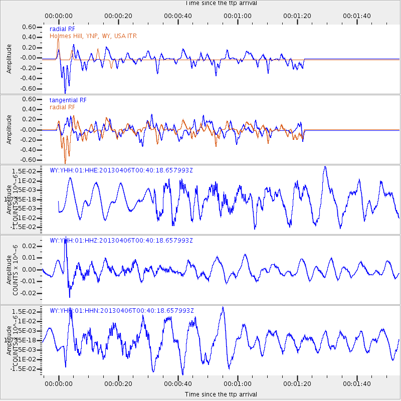
YHH Holmes Hill, YNP, WY, USA - Earthquake Result Viewer
*The percent match for this event was below the threshold and hence no stack was calculated.
| Earthquake location: |
E. Russia-N.E. China Border Reg. |
| Earthquake latitude/longitude: |
42.7/131.0 |
| Earthquake time(UTC): |
2013/04/06 (096) 00:29:55 GMT |
| Earthquake Depth: |
563 km |
| Earthquake Magnitude: |
5.8 MW, 5.5 MB, 5.9 MW |
| Earthquake Catalog/Contributor: |
NEIC PDE/NEIC PDE-W |
|
| Network: |
WY Yellowstone Wyoming Seismic Network |
| Station: |
YHH Holmes Hill, YNP, WY, USA |
| Lat/Lon: |
44.79 N/110.85 W |
| Elevation: |
2717 m |
|
| Distance: |
76.9 deg |
| Az: |
40.13 deg |
| Baz: |
318.167 deg |
| Ray Param: |
$rayparam |
*The percent match for this event was below the threshold and hence was not used in the summary stack. |
|
| Radial Match: |
70.280235 % |
| Radial Bump: |
341 |
| Transverse Match: |
57.320923 % |
| Transverse Bump: |
395 |
| SOD ConfigId: |
512894 |
| Insert Time: |
2013-09-13 02:07:17.714 +0000 |
| GWidth: |
2.5 |
| Max Bumps: |
400 |
| Tol: |
0.001 |
|
Signal To Noise
| Channel | StoN | STA | LTA |
| WY:YHH:01:HHZ:20130406T00:40:18.657993Z | 3.6902182 | 1.2529899E-8 | 3.395436E-9 |
| WY:YHH:01:HHN:20130406T00:40:18.657993Z | 1.3959855 | 7.898906E-9 | 5.6583014E-9 |
| WY:YHH:01:HHE:20130406T00:40:18.657993Z | 0.9732532 | 5.8601435E-9 | 6.021191E-9 |
| Arrivals |
| Ps | |
| PpPs | |
| PsPs/PpSs | |


