You are here: Home > Network List > TA - USArray Transportable Network (new EarthScope stations) Stations List
> Station A04D Lummi Island, WA, USA > Earthquake Result Viewer
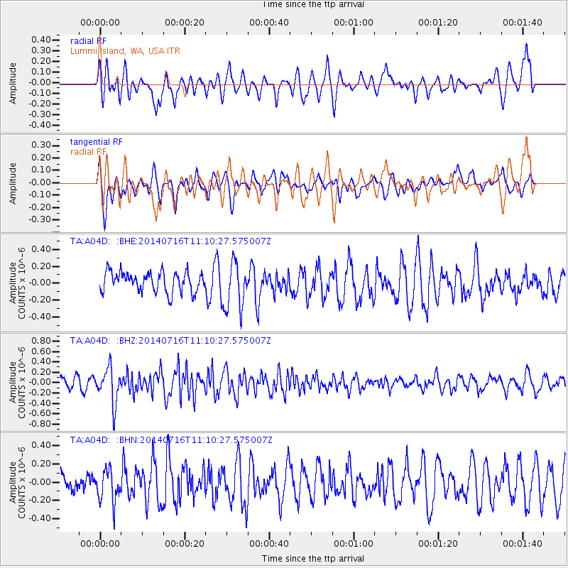
A04D Lummi Island, WA, USA - Earthquake Result Viewer
*The percent match for this event was below the threshold and hence no stack was calculated.
| Earthquake location: |
Tonga Islands |
| Earthquake latitude/longitude: |
-21.9/-175.6 |
| Earthquake time(UTC): |
2014/07/16 (197) 10:58:28 GMT |
| Earthquake Depth: |
32 km |
| Earthquake Magnitude: |
5.6 Mwc, 5.3 mb, 5.1 Ms_20, 5.4 Mwb |
| Earthquake Catalog/Contributor: |
ISC/ISC |
|
| Network: |
TA USArray Transportable Network (new EarthScope stations) |
| Station: |
A04D Lummi Island, WA, USA |
| Lat/Lon: |
48.72 N/122.71 W |
| Elevation: |
13 m |
|
| Distance: |
84.7 deg |
| Az: |
32.016 deg |
| Baz: |
228.017 deg |
| Ray Param: |
$rayparam |
*The percent match for this event was below the threshold and hence was not used in the summary stack. |
|
| Radial Match: |
58.13023 % |
| Radial Bump: |
400 |
| Transverse Match: |
58.095345 % |
| Transverse Bump: |
400 |
| SOD ConfigId: |
3390531 |
| Insert Time: |
2019-04-12 21:34:47.714 +0000 |
| GWidth: |
2.5 |
| Max Bumps: |
400 |
| Tol: |
0.001 |
|
Signal To Noise
| Channel | StoN | STA | LTA |
| TA:A04D: :BHZ:20140716T11:10:27.575007Z | 3.182917 | 3.4635062E-7 | 1.0881546E-7 |
| TA:A04D: :BHN:20140716T11:10:27.575007Z | 1.2830042 | 1.791891E-7 | 1.3966368E-7 |
| TA:A04D: :BHE:20140716T11:10:27.575007Z | 2.4072053 | 2.7907694E-7 | 1.15934E-7 |
| Arrivals |
| Ps | |
| PpPs | |
| PsPs/PpSs | |


