You are here: Home > Network List > US - United States National Seismic Network Stations List
> Station HAWA Hanford, Washington, USA > Earthquake Result Viewer
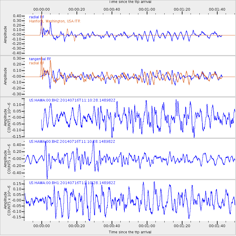
HAWA Hanford, Washington, USA - Earthquake Result Viewer
*The percent match for this event was below the threshold and hence no stack was calculated.
| Earthquake location: |
Tonga Islands |
| Earthquake latitude/longitude: |
-21.9/-175.6 |
| Earthquake time(UTC): |
2014/07/16 (197) 10:58:28 GMT |
| Earthquake Depth: |
32 km |
| Earthquake Magnitude: |
5.6 Mwc, 5.3 mb, 5.1 Ms_20, 5.4 Mwb |
| Earthquake Catalog/Contributor: |
ISC/ISC |
|
| Network: |
US United States National Seismic Network |
| Station: |
HAWA Hanford, Washington, USA |
| Lat/Lon: |
46.39 N/119.53 W |
| Elevation: |
364 m |
|
| Distance: |
84.8 deg |
| Az: |
35.197 deg |
| Baz: |
230.646 deg |
| Ray Param: |
$rayparam |
*The percent match for this event was below the threshold and hence was not used in the summary stack. |
|
| Radial Match: |
56.85538 % |
| Radial Bump: |
400 |
| Transverse Match: |
54.964817 % |
| Transverse Bump: |
383 |
| SOD ConfigId: |
3390531 |
| Insert Time: |
2019-04-12 21:35:40.584 +0000 |
| GWidth: |
2.5 |
| Max Bumps: |
400 |
| Tol: |
0.001 |
|
Signal To Noise
| Channel | StoN | STA | LTA |
| US:HAWA:00:BHZ:20140716T11:10:28.148982Z | 3.1199563 | 2.400077E-7 | 7.6926625E-8 |
| US:HAWA:00:BH1:20140716T11:10:28.148982Z | 0.55747044 | 3.1038326E-8 | 5.5677077E-8 |
| US:HAWA:00:BH2:20140716T11:10:28.148982Z | 1.0863461 | 5.3664618E-8 | 4.9399187E-8 |
| Arrivals |
| Ps | |
| PpPs | |
| PsPs/PpSs | |


