You are here: Home > Network List > UW - Pacific Northwest Regional Seismic Network Stations List
> Station MRBL Marblemount, WA, USA > Earthquake Result Viewer
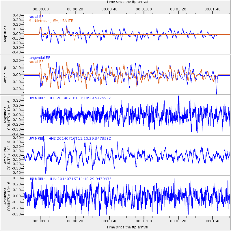
MRBL Marblemount, WA, USA - Earthquake Result Viewer
*The percent match for this event was below the threshold and hence no stack was calculated.
| Earthquake location: |
Tonga Islands |
| Earthquake latitude/longitude: |
-21.9/-175.6 |
| Earthquake time(UTC): |
2014/07/16 (197) 10:58:28 GMT |
| Earthquake Depth: |
32 km |
| Earthquake Magnitude: |
5.6 Mwc, 5.3 mb, 5.1 Ms_20, 5.4 Mwb |
| Earthquake Catalog/Contributor: |
ISC/ISC |
|
| Network: |
UW Pacific Northwest Regional Seismic Network |
| Station: |
MRBL Marblemount, WA, USA |
| Lat/Lon: |
48.52 N/121.48 W |
| Elevation: |
75 m |
|
| Distance: |
85.1 deg |
| Az: |
32.707 deg |
| Baz: |
228.993 deg |
| Ray Param: |
$rayparam |
*The percent match for this event was below the threshold and hence was not used in the summary stack. |
|
| Radial Match: |
54.880795 % |
| Radial Bump: |
400 |
| Transverse Match: |
58.87263 % |
| Transverse Bump: |
400 |
| SOD ConfigId: |
3390531 |
| Insert Time: |
2019-04-12 21:36:17.108 +0000 |
| GWidth: |
2.5 |
| Max Bumps: |
400 |
| Tol: |
0.001 |
|
Signal To Noise
| Channel | StoN | STA | LTA |
| UW:MRBL: :HHZ:20140716T11:10:29.947993Z | 3.3402636 | 1.9894257E-7 | 5.9558946E-8 |
| UW:MRBL: :HHN:20140716T11:10:29.947993Z | 1.048089 | 9.2453625E-8 | 8.8211614E-8 |
| UW:MRBL: :HHE:20140716T11:10:29.947993Z | 1.0961406 | 8.847172E-8 | 8.071202E-8 |
| Arrivals |
| Ps | |
| PpPs | |
| PsPs/PpSs | |


