VNDA Wright Valley (Bull Pass) Antarctica - Earthquake Result Viewer
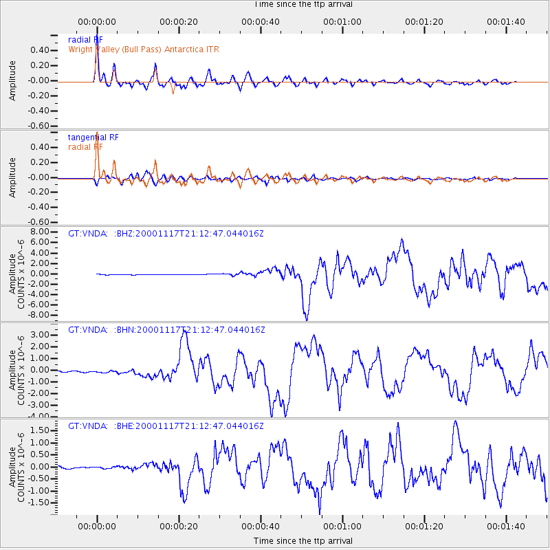
Earthquake location: New Britain Region, P.N.G.
Earthquake latitude/longitude: -5.5/151.8
Earthquake time(UTC): 2000/11/17 (322) 21:01:56 GMT
Earthquake Depth: 33 km
Earthquake Magnitude: 6.2 MB, 8.0 MS, 7.6 MW, 6.9 ME
Earthquake Catalog/Contributor: WHDF/NEIC
Network: GT Global Telemetered Seismograph Network (USAF/USGS)
Station: VNDA Wright Valley (Bull Pass) Antarctica
Lat/Lon: 77.52 S/161.85 E
Elevation: 151 m
Distance: 72.2 deg
Az: 177.71 deg
Baz: 349.463 deg
Ray Param: 0.053784862
Estimated Moho Depth: 10.0 km
Estimated Crust Vp/Vs: 1.89
Assumed Crust Vp: 6.245 km/s
Estimated Crust Vs: 3.308 km/s
Estimated Crust Poisson's Ratio: 0.30
Radial Match: 97.63744 %
Radial Bump: 348
Transverse Match: 94.70857 %
Transverse Bump: 400
SOD ConfigId: 3744
Insert Time: 2010-02-27 02:27:43.035 +0000
GWidth: 2.5
Max Bumps: 400
Tol: 0.001

Signal To Noise

ChannelStoNSTALTA
GT:VNDA: :BHN:20001117T21:12:47.044016Z1.95575377.5406135E-83.855605E-8
GT:VNDA: :BHE:20001117T21:12:47.044016Z0.959106454.026866E-84.19856E-8
GT:VNDA: :BHZ:20001117T21:12:47.044016Z4.26553251.7307288E-74.057474E-8
Arrivals
Ps1.5 SECOND
PpPs4.5 SECOND
PsPs/PpSs5.9 SECOND