You are here: Home > Network List > AK - Alaska Regional Network Stations List
> Station MDM Murphy Dome > Earthquake Result Viewer
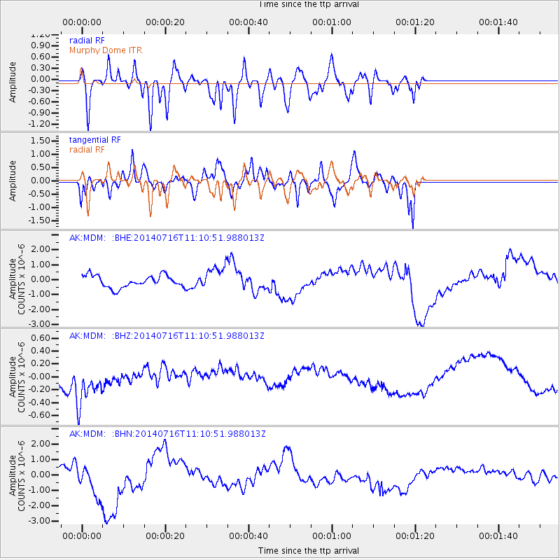
MDM Murphy Dome - Earthquake Result Viewer
*The percent match for this event was below the threshold and hence no stack was calculated.
| Earthquake location: |
Tonga Islands Region |
| Earthquake latitude/longitude: |
-22.0/-174.9 |
| Earthquake time(UTC): |
2014/07/16 (197) 10:58:32 GMT |
| Earthquake Depth: |
43 km |
| Earthquake Magnitude: |
5.6 MW |
| Earthquake Catalog/Contributor: |
ISC/ISC |
|
| Network: |
AK Alaska Regional Network |
| Station: |
MDM Murphy Dome |
| Lat/Lon: |
64.96 N/148.23 W |
| Elevation: |
634 m |
|
| Distance: |
89.1 deg |
| Az: |
10.999 deg |
| Baz: |
204.578 deg |
| Ray Param: |
$rayparam |
*The percent match for this event was below the threshold and hence was not used in the summary stack. |
|
| Radial Match: |
49.15663 % |
| Radial Bump: |
400 |
| Transverse Match: |
37.87845 % |
| Transverse Bump: |
349 |
| SOD ConfigId: |
3390531 |
| Insert Time: |
2019-04-12 21:39:06.235 +0000 |
| GWidth: |
2.5 |
| Max Bumps: |
400 |
| Tol: |
0.001 |
|
Signal To Noise
| Channel | StoN | STA | LTA |
| AK:MDM: :BHZ:20140716T11:10:51.988013Z | 1.8063065 | 4.0439767E-7 | 2.2388097E-7 |
| AK:MDM: :BHN:20140716T11:10:51.988013Z | 3.0461786 | 1.2118297E-6 | 3.978197E-7 |
| AK:MDM: :BHE:20140716T11:10:51.988013Z | 2.0248117 | 8.1275437E-7 | 4.013975E-7 |
| Arrivals |
| Ps | |
| PpPs | |
| PsPs/PpSs | |


