You are here: Home > Network List > CN - Canadian National Seismograph Network Stations List
> Station INK INUVIK, NT > Earthquake Result Viewer
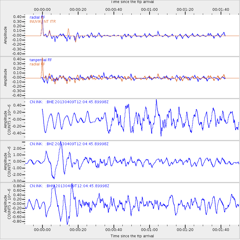
INK INUVIK, NT - Earthquake Result Viewer
*The percent match for this event was below the threshold and hence no stack was calculated.
| Earthquake location: |
Southern Iran |
| Earthquake latitude/longitude: |
28.4/51.6 |
| Earthquake time(UTC): |
2013/04/09 (099) 11:52:49 GMT |
| Earthquake Depth: |
12 km |
| Earthquake Magnitude: |
6.4 MW, 5.9 MB, 6.2 MW, 6.3 MS |
| Earthquake Catalog/Contributor: |
NEIC PDE/NEIC PDE-W |
|
| Network: |
CN Canadian National Seismograph Network |
| Station: |
INK INUVIK, NT |
| Lat/Lon: |
68.31 N/133.53 W |
| Elevation: |
44 m |
|
| Distance: |
83.5 deg |
| Az: |
1.913 deg |
| Baz: |
355.464 deg |
| Ray Param: |
$rayparam |
*The percent match for this event was below the threshold and hence was not used in the summary stack. |
|
| Radial Match: |
78.39732 % |
| Radial Bump: |
321 |
| Transverse Match: |
73.313866 % |
| Transverse Bump: |
400 |
| SOD ConfigId: |
512894 |
| Insert Time: |
2013-09-13 03:05:30.698 +0000 |
| GWidth: |
2.5 |
| Max Bumps: |
400 |
| Tol: |
0.001 |
|
Signal To Noise
| Channel | StoN | STA | LTA |
| CN:INK: :BHZ:20130409T12:04:45.89998Z | 4.1246586 | 6.6689284E-7 | 1.6168438E-7 |
| CN:INK: :BHN:20130409T12:04:45.89998Z | 1.3360438 | 2.5309976E-7 | 1.8943972E-7 |
| CN:INK: :BHE:20130409T12:04:45.89998Z | 0.49250832 | 7.060121E-8 | 1.4335029E-7 |
| Arrivals |
| Ps | |
| PpPs | |
| PsPs/PpSs | |


