You are here: Home > Network List > CN - Canadian National Seismograph Network Stations List
> Station INK INUVIK, NT > Earthquake Result Viewer
INK INUVIK, NT - Earthquake Result Viewer
*The percent match for this event was below the threshold and hence no stack was calculated.
| Earthquake location: |
Tonga Islands Region |
| Earthquake latitude/longitude: |
-22.0/-174.9 |
| Earthquake time(UTC): |
2014/07/16 (197) 10:58:32 GMT |
| Earthquake Depth: |
43 km |
| Earthquake Magnitude: |
5.6 MW |
| Earthquake Catalog/Contributor: |
ISC/ISC |
|
| Network: |
CN Canadian National Seismograph Network |
| Station: |
INK INUVIK, NT |
| Lat/Lon: |
68.31 N/133.53 W |
| Elevation: |
44 m |
|
| Distance: |
95.0 deg |
| Az: |
14.27 deg |
| Baz: |
217.96 deg |
| Ray Param: |
$rayparam |
*The percent match for this event was below the threshold and hence was not used in the summary stack. |
|
| Radial Match: |
56.130726 % |
| Radial Bump: |
400 |
| Transverse Match: |
47.586956 % |
| Transverse Bump: |
400 |
| SOD ConfigId: |
3390531 |
| Insert Time: |
2019-04-12 21:41:01.040 +0000 |
| GWidth: |
2.5 |
| Max Bumps: |
400 |
| Tol: |
0.001 |
|
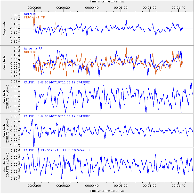
Signal To Noise
| Channel | StoN | STA | LTA |
| CN:INK: :BHZ:20140716T11:11:19.074988Z | 2.4441853 | 1.578354E-7 | 6.457587E-8 |
| CN:INK: :BHN:20140716T11:11:19.074988Z | 1.3868294 | 6.1155895E-8 | 4.4097636E-8 |
| CN:INK: :BHE:20140716T11:11:19.074988Z | 0.89284986 | 3.5272425E-8 | 3.9505437E-8 |
| Arrivals |
| Ps | |
| PpPs | |
| PsPs/PpSs | |


