
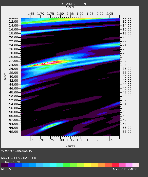
VNDA Wright Valley (Bull Pass) Antarctica - Earthquake Result Viewer
| ||||||||||||||||||
| ||||||||||||||||||
| ||||||||||||||||||
|
Signal To Noise
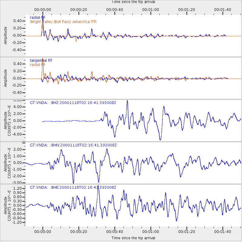
| Channel | StoN | STA | LTA |
| GT:VNDA: :BHN:20001118T02:16:41.393008Z | 2.783963 | 3.0705598E-7 | 1.10294565E-7 |
| GT:VNDA: :BHE:20001118T02:16:41.393008Z | 0.9316101 | 7.943091E-8 | 8.5261966E-8 |
| GT:VNDA: :BHZ:20001118T02:16:41.393008Z | 10.676388 | 9.2441155E-7 | 8.658467E-8 |
| Arrivals | |
| Ps | 3.9 SECOND |
| PpPs | 14 SECOND |
| PsPs/PpSs | 18 SECOND |

