
ZOU2 Zouf Plan - Earthquake Result Viewer
| ||||||||||||||||||
| ||||||||||||||||||
| ||||||||||||||||||
|

Signal To Noise
| Channel | StoN | STA | LTA |
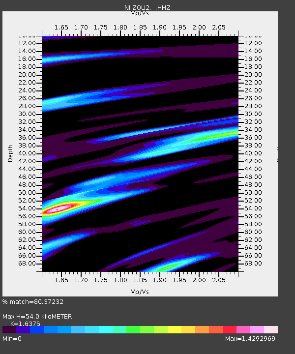
| NI:ZOU2: :HHZ:20130409T11:59:12.617998Z | 5.473928 | 6.896961E-7 | 1.2599656E-7 |
| NI:ZOU2: :HHN:20130409T11:59:12.617998Z | 0.96861 | 2.3449728E-7 | 2.420967E-7 |
| NI:ZOU2: :HHE:20130409T11:59:12.617998Z | 2.7022817 | 4.1325472E-7 | 1.5292807E-7 |
| Arrivals | |
| Ps | 5.9 SECOND |
| PpPs | 21 SECOND |
| PsPs/PpSs | 27 SECOND |

