You are here: Home > Network List > US - United States National Seismic Network Stations List
> Station AMTX Amarillo, Texas, USA > Earthquake Result Viewer
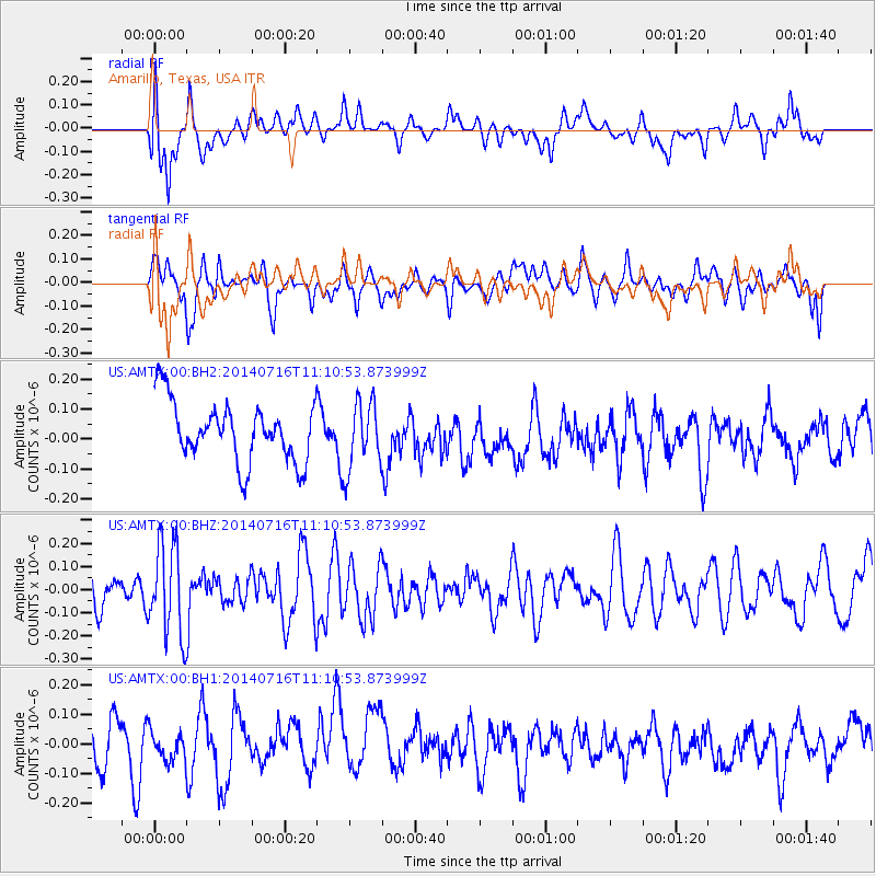
AMTX Amarillo, Texas, USA - Earthquake Result Viewer
*The percent match for this event was below the threshold and hence no stack was calculated.
| Earthquake location: |
Tonga Islands Region |
| Earthquake latitude/longitude: |
-22.0/-174.9 |
| Earthquake time(UTC): |
2014/07/16 (197) 10:58:32 GMT |
| Earthquake Depth: |
43 km |
| Earthquake Magnitude: |
5.6 MW |
| Earthquake Catalog/Contributor: |
ISC/ISC |
|
| Network: |
US United States National Seismic Network |
| Station: |
AMTX Amarillo, Texas, USA |
| Lat/Lon: |
34.53 N/101.41 W |
| Elevation: |
1010 m |
|
| Distance: |
89.6 deg |
| Az: |
52.319 deg |
| Baz: |
242.797 deg |
| Ray Param: |
$rayparam |
*The percent match for this event was below the threshold and hence was not used in the summary stack. |
|
| Radial Match: |
52.32204 % |
| Radial Bump: |
400 |
| Transverse Match: |
65.425316 % |
| Transverse Bump: |
400 |
| SOD ConfigId: |
3390531 |
| Insert Time: |
2019-04-12 21:44:03.433 +0000 |
| GWidth: |
2.5 |
| Max Bumps: |
400 |
| Tol: |
0.001 |
|
Signal To Noise
| Channel | StoN | STA | LTA |
| US:AMTX:00:BHZ:20140716T11:10:53.873999Z | 2.3798623 | 2.0180258E-7 | 8.47959E-8 |
| US:AMTX:00:BH1:20140716T11:10:53.873999Z | 0.6386598 | 4.950223E-8 | 7.750955E-8 |
| US:AMTX:00:BH2:20140716T11:10:53.873999Z | 1.111157 | 1.09897904E-7 | 9.890404E-8 |
| Arrivals |
| Ps | |
| PpPs | |
| PsPs/PpSs | |


