You are here: Home > Network List > CN - Canadian National Seismograph Network Stations List
> Station INK INUVIK, NT > Earthquake Result Viewer
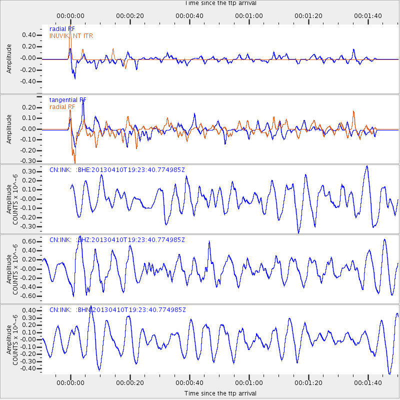
INK INUVIK, NT - Earthquake Result Viewer
*The percent match for this event was below the threshold and hence no stack was calculated.
| Earthquake location: |
Honduras |
| Earthquake latitude/longitude: |
15.5/-87.2 |
| Earthquake time(UTC): |
2013/04/10 (100) 19:14:01 GMT |
| Earthquake Depth: |
3.5 km |
| Earthquake Magnitude: |
5.5 MW |
| Earthquake Catalog/Contributor: |
NEIC PDE/NEIC PDE-W |
|
| Network: |
CN Canadian National Seismograph Network |
| Station: |
INK INUVIK, NT |
| Lat/Lon: |
68.31 N/133.53 W |
| Elevation: |
44 m |
|
| Distance: |
60.4 deg |
| Az: |
341.97 deg |
| Baz: |
126.626 deg |
| Ray Param: |
$rayparam |
*The percent match for this event was below the threshold and hence was not used in the summary stack. |
|
| Radial Match: |
61.988144 % |
| Radial Bump: |
400 |
| Transverse Match: |
73.788994 % |
| Transverse Bump: |
400 |
| SOD ConfigId: |
512894 |
| Insert Time: |
2013-09-13 03:53:13.299 +0000 |
| GWidth: |
2.5 |
| Max Bumps: |
400 |
| Tol: |
0.001 |
|
Signal To Noise
| Channel | StoN | STA | LTA |
| CN:INK: :BHZ:20130410T19:23:40.774985Z | 2.1891122 | 4.3804312E-7 | 2.0010079E-7 |
| CN:INK: :BHN:20130410T19:23:40.774985Z | 0.79627544 | 1.419875E-7 | 1.7831456E-7 |
| CN:INK: :BHE:20130410T19:23:40.774985Z | 1.4963249 | 1.5465926E-7 | 1.03359405E-7 |
| Arrivals |
| Ps | |
| PpPs | |
| PsPs/PpSs | |


