You are here: Home > Network List > UW - Pacific Northwest Regional Seismic Network Stations List
> Station UMAT Pilot Rock, OR, USA > Earthquake Result Viewer
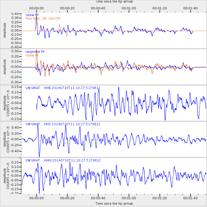
UMAT Pilot Rock, OR, USA - Earthquake Result Viewer
*The percent match for this event was below the threshold and hence no stack was calculated.
| Earthquake location: |
Tonga Islands Region |
| Earthquake latitude/longitude: |
-22.0/-174.9 |
| Earthquake time(UTC): |
2014/07/16 (197) 10:58:32 GMT |
| Earthquake Depth: |
43 km |
| Earthquake Magnitude: |
5.6 MW |
| Earthquake Catalog/Contributor: |
ISC/ISC |
|
| Network: |
UW Pacific Northwest Regional Seismic Network |
| Station: |
UMAT Pilot Rock, OR, USA |
| Lat/Lon: |
45.29 N/118.96 W |
| Elevation: |
1318 m |
|
| Distance: |
84.1 deg |
| Az: |
35.99 deg |
| Baz: |
230.568 deg |
| Ray Param: |
$rayparam |
*The percent match for this event was below the threshold and hence was not used in the summary stack. |
|
| Radial Match: |
76.788 % |
| Radial Bump: |
400 |
| Transverse Match: |
56.196213 % |
| Transverse Bump: |
400 |
| SOD ConfigId: |
3390531 |
| Insert Time: |
2019-04-12 21:44:52.501 +0000 |
| GWidth: |
2.5 |
| Max Bumps: |
400 |
| Tol: |
0.001 |
|
Signal To Noise
| Channel | StoN | STA | LTA |
| UW:UMAT: :HHZ:20140716T11:10:27.517981Z | 6.580159 | 2.6092263E-7 | 3.9652935E-8 |
| UW:UMAT: :HHN:20140716T11:10:27.517981Z | 2.1293242 | 9.910741E-8 | 4.6544066E-8 |
| UW:UMAT: :HHE:20140716T11:10:27.517981Z | 1.7505931 | 6.8321214E-8 | 3.902747E-8 |
| Arrivals |
| Ps | |
| PpPs | |
| PsPs/PpSs | |


