You are here: Home > Network List > IU - Global Seismograph Network (GSN - IRIS/USGS) Stations List
> Station RSSD Black Hills, South Dakota, USA > Earthquake Result Viewer
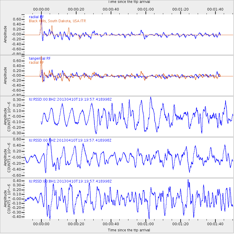
RSSD Black Hills, South Dakota, USA - Earthquake Result Viewer
*The percent match for this event was below the threshold and hence no stack was calculated.
| Earthquake location: |
Honduras |
| Earthquake latitude/longitude: |
15.5/-87.2 |
| Earthquake time(UTC): |
2013/04/10 (100) 19:14:01 GMT |
| Earthquake Depth: |
3.5 km |
| Earthquake Magnitude: |
5.5 MW |
| Earthquake Catalog/Contributor: |
NEIC PDE/NEIC PDE-W |
|
| Network: |
IU Global Seismograph Network (GSN - IRIS/USGS) |
| Station: |
RSSD Black Hills, South Dakota, USA |
| Lat/Lon: |
44.12 N/104.04 W |
| Elevation: |
2090 m |
|
| Distance: |
31.9 deg |
| Az: |
336.701 deg |
| Baz: |
148.034 deg |
| Ray Param: |
$rayparam |
*The percent match for this event was below the threshold and hence was not used in the summary stack. |
|
| Radial Match: |
71.29701 % |
| Radial Bump: |
400 |
| Transverse Match: |
60.4584 % |
| Transverse Bump: |
400 |
| SOD ConfigId: |
512894 |
| Insert Time: |
2013-09-13 03:59:14.925 +0000 |
| GWidth: |
2.5 |
| Max Bumps: |
400 |
| Tol: |
0.001 |
|
Signal To Noise
| Channel | StoN | STA | LTA |
| IU:RSSD:00:BHZ:20130410T19:19:57.418998Z | 4.2465744 | 3.0263735E-7 | 7.126623E-8 |
| IU:RSSD:00:BH1:20130410T19:19:57.418998Z | 3.6463196 | 2.1983324E-7 | 6.0289075E-8 |
| IU:RSSD:00:BH2:20130410T19:19:57.418998Z | 1.5840074 | 1.6603676E-7 | 1.0482069E-7 |
| Arrivals |
| Ps | |
| PpPs | |
| PsPs/PpSs | |


