You are here: Home > Network List > IW - Intermountain West Stations List
> Station MOOW Moose Ponds, Wyoming, USA > Earthquake Result Viewer
MOOW Moose Ponds, Wyoming, USA - Earthquake Result Viewer
*The percent match for this event was below the threshold and hence no stack was calculated.
| Earthquake location: |
Honduras |
| Earthquake latitude/longitude: |
15.5/-87.2 |
| Earthquake time(UTC): |
2013/04/10 (100) 19:14:01 GMT |
| Earthquake Depth: |
3.5 km |
| Earthquake Magnitude: |
5.5 MW |
| Earthquake Catalog/Contributor: |
NEIC PDE/NEIC PDE-W |
|
| Network: |
IW Intermountain West |
| Station: |
MOOW Moose Ponds, Wyoming, USA |
| Lat/Lon: |
43.75 N/110.74 W |
| Elevation: |
2128 m |
|
| Distance: |
34.6 deg |
| Az: |
329.264 deg |
| Baz: |
137.168 deg |
| Ray Param: |
$rayparam |
*The percent match for this event was below the threshold and hence was not used in the summary stack. |
|
| Radial Match: |
76.89543 % |
| Radial Bump: |
400 |
| Transverse Match: |
68.183876 % |
| Transverse Bump: |
400 |
| SOD ConfigId: |
512894 |
| Insert Time: |
2013-09-13 03:59:41.626 +0000 |
| GWidth: |
2.5 |
| Max Bumps: |
400 |
| Tol: |
0.001 |
|
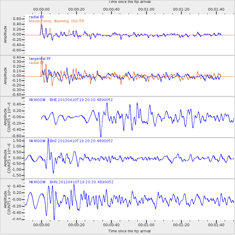
Signal To Noise
| Channel | StoN | STA | LTA |
| IW:MOOW: :BHZ:20130410T19:20:20.489005Z | 4.8494368 | 6.311021E-7 | 1.3013926E-7 |
| IW:MOOW: :BHN:20130410T19:20:20.489005Z | 2.7006328 | 2.3846616E-7 | 8.8300105E-8 |
| IW:MOOW: :BHE:20130410T19:20:20.489005Z | 3.5772998 | 2.559892E-7 | 7.1559334E-8 |
| Arrivals |
| Ps | |
| PpPs | |
| PsPs/PpSs | |


