You are here: Home > Network List > IW - Intermountain West Stations List
> Station PLID Pearl Lake, Idaho, USA > Earthquake Result Viewer
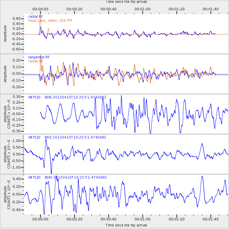
PLID Pearl Lake, Idaho, USA - Earthquake Result Viewer
*The percent match for this event was below the threshold and hence no stack was calculated.
| Earthquake location: |
Honduras |
| Earthquake latitude/longitude: |
15.5/-87.2 |
| Earthquake time(UTC): |
2013/04/10 (100) 19:14:01 GMT |
| Earthquake Depth: |
3.5 km |
| Earthquake Magnitude: |
5.5 MW |
| Earthquake Catalog/Contributor: |
NEIC PDE/NEIC PDE-W |
|
| Network: |
IW Intermountain West |
| Station: |
PLID Pearl Lake, Idaho, USA |
| Lat/Lon: |
45.09 N/116.00 W |
| Elevation: |
2164 m |
|
| Distance: |
38.2 deg |
| Az: |
326.455 deg |
| Baz: |
131.238 deg |
| Ray Param: |
$rayparam |
*The percent match for this event was below the threshold and hence was not used in the summary stack. |
|
| Radial Match: |
70.95439 % |
| Radial Bump: |
400 |
| Transverse Match: |
66.37572 % |
| Transverse Bump: |
400 |
| SOD ConfigId: |
512894 |
| Insert Time: |
2013-09-13 03:59:51.460 +0000 |
| GWidth: |
2.5 |
| Max Bumps: |
400 |
| Tol: |
0.001 |
|
Signal To Noise
| Channel | StoN | STA | LTA |
| IW:PLID: :BHZ:20130410T19:20:51.474998Z | 2.5569293 | 5.651286E-7 | 2.2101847E-7 |
| IW:PLID: :BHN:20130410T19:20:51.474998Z | 2.8371117 | 2.4503447E-7 | 8.636758E-8 |
| IW:PLID: :BHE:20130410T19:20:51.474998Z | 1.4637606 | 1.4921423E-7 | 1.0193895E-7 |
| Arrivals |
| Ps | |
| PpPs | |
| PsPs/PpSs | |


