You are here: Home > Network List > NI - North-East Italy Broadband Network Stations List
> Station CGRP Cima Grappa > Earthquake Result Viewer
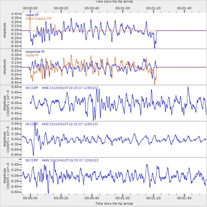
CGRP Cima Grappa - Earthquake Result Viewer
*The percent match for this event was below the threshold and hence no stack was calculated.
| Earthquake location: |
Honduras |
| Earthquake latitude/longitude: |
15.5/-87.2 |
| Earthquake time(UTC): |
2013/04/10 (100) 19:14:01 GMT |
| Earthquake Depth: |
3.5 km |
| Earthquake Magnitude: |
5.5 MW |
| Earthquake Catalog/Contributor: |
NEIC PDE/NEIC PDE-W |
|
| Network: |
NI North-East Italy Broadband Network |
| Station: |
CGRP Cima Grappa |
| Lat/Lon: |
45.88 N/11.80 E |
| Elevation: |
1757 m |
|
| Distance: |
85.1 deg |
| Az: |
43.833 deg |
| Baz: |
287.116 deg |
| Ray Param: |
$rayparam |
*The percent match for this event was below the threshold and hence was not used in the summary stack. |
|
| Radial Match: |
67.84111 % |
| Radial Bump: |
400 |
| Transverse Match: |
55.416603 % |
| Transverse Bump: |
400 |
| SOD ConfigId: |
512894 |
| Insert Time: |
2013-09-13 04:01:42.549 +0000 |
| GWidth: |
2.5 |
| Max Bumps: |
400 |
| Tol: |
0.001 |
|
Signal To Noise
| Channel | StoN | STA | LTA |
| NI:CGRP: :HHZ:20130410T19:26:07.128013Z | 4.20187 | 4.786401E-7 | 1.1391121E-7 |
| NI:CGRP: :HHN:20130410T19:26:07.128013Z | 1.1003106 | 1.9258964E-7 | 1.7503207E-7 |
| NI:CGRP: :HHE:20130410T19:26:07.128013Z | 0.78403133 | 1.262112E-7 | 1.6097724E-7 |
| Arrivals |
| Ps | |
| PpPs | |
| PsPs/PpSs | |


