
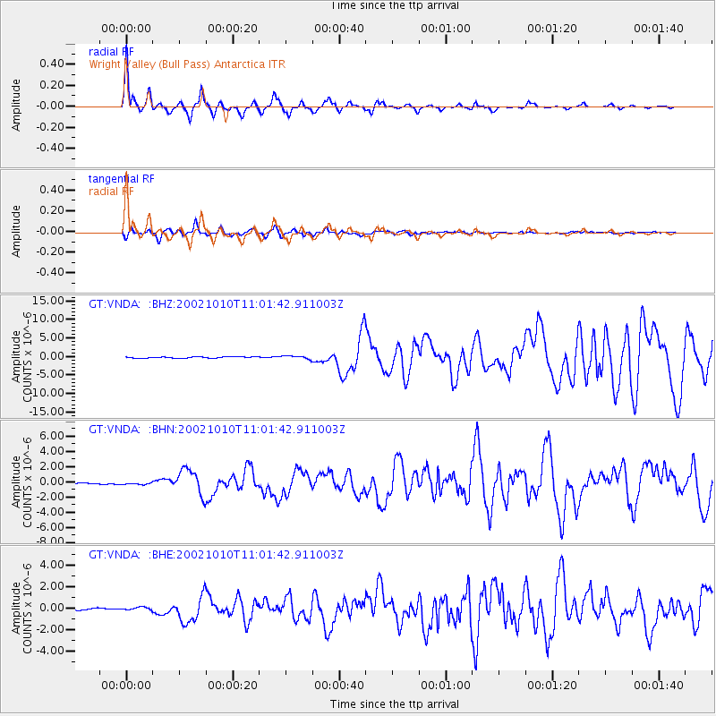
VNDA Wright Valley (Bull Pass) Antarctica - Earthquake Result Viewer
| ||||||||||||||||||
| ||||||||||||||||||
| ||||||||||||||||||
|
Signal To Noise
| Channel | StoN | STA | LTA |
| GT:VNDA: :BHN:20021010T11:01:42.911003Z | 0.9965485 | 1.1950522E-7 | 1.1991911E-7 |
| GT:VNDA: :BHE:20021010T11:01:42.911003Z | 1.8875276 | 1.4711843E-7 | 7.79424E-8 |
| GT:VNDA: :BHZ:20021010T11:01:42.911003Z | 2.448009 | 4.111813E-7 | 1.6796561E-7 |
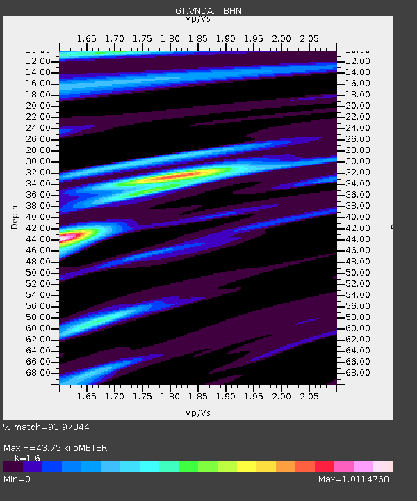
| Arrivals | |
| Ps | 4.3 SECOND |
| PpPs | 18 SECOND |
| PsPs/PpSs | 22 SECOND |

