You are here: Home > Network List > TA - USArray Transportable Network (new EarthScope stations) Stations List
> Station E40A Wakefield, MI, USA > Earthquake Result Viewer
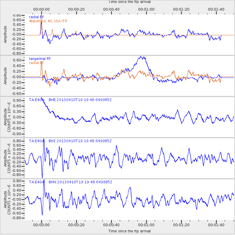
E40A Wakefield, MI, USA - Earthquake Result Viewer
*The percent match for this event was below the threshold and hence no stack was calculated.
| Earthquake location: |
Honduras |
| Earthquake latitude/longitude: |
15.5/-87.2 |
| Earthquake time(UTC): |
2013/04/10 (100) 19:14:01 GMT |
| Earthquake Depth: |
3.5 km |
| Earthquake Magnitude: |
5.5 MW |
| Earthquake Catalog/Contributor: |
NEIC PDE/NEIC PDE-W |
|
| Network: |
TA USArray Transportable Network (new EarthScope stations) |
| Station: |
E40A Wakefield, MI, USA |
| Lat/Lon: |
46.44 N/89.90 W |
| Elevation: |
472 m |
|
| Distance: |
30.9 deg |
| Az: |
356.311 deg |
| Baz: |
174.854 deg |
| Ray Param: |
$rayparam |
*The percent match for this event was below the threshold and hence was not used in the summary stack. |
|
| Radial Match: |
52.548283 % |
| Radial Bump: |
400 |
| Transverse Match: |
48.525265 % |
| Transverse Bump: |
400 |
| SOD ConfigId: |
512894 |
| Insert Time: |
2013-09-13 04:06:14.036 +0000 |
| GWidth: |
2.5 |
| Max Bumps: |
400 |
| Tol: |
0.001 |
|
Signal To Noise
| Channel | StoN | STA | LTA |
| TA:E40A: :BHZ:20130410T19:19:48.649985Z | 3.3991213 | 4.3753045E-7 | 1.287187E-7 |
| TA:E40A: :BHN:20130410T19:19:48.649985Z | 2.8266444 | 3.6232558E-7 | 1.2818222E-7 |
| TA:E40A: :BHE:20130410T19:19:48.649985Z | 0.7641637 | 2.4961972E-7 | 3.266574E-7 |
| Arrivals |
| Ps | |
| PpPs | |
| PsPs/PpSs | |


