You are here: Home > Network List > TA - USArray Transportable Network (new EarthScope stations) Stations List
> Station L04D Klamath Falls, OR, USA > Earthquake Result Viewer
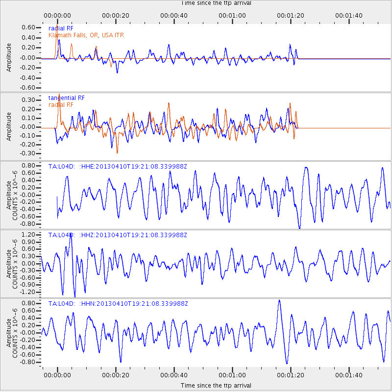
L04D Klamath Falls, OR, USA - Earthquake Result Viewer
*The percent match for this event was below the threshold and hence no stack was calculated.
| Earthquake location: |
Honduras |
| Earthquake latitude/longitude: |
15.5/-87.2 |
| Earthquake time(UTC): |
2013/04/10 (100) 19:14:01 GMT |
| Earthquake Depth: |
3.5 km |
| Earthquake Magnitude: |
5.5 MW |
| Earthquake Catalog/Contributor: |
NEIC PDE/NEIC PDE-W |
|
| Network: |
TA USArray Transportable Network (new EarthScope stations) |
| Station: |
L04D Klamath Falls, OR, USA |
| Lat/Lon: |
42.22 N/122.30 W |
| Elevation: |
1437 m |
|
| Distance: |
40.2 deg |
| Az: |
318.531 deg |
| Baz: |
120.753 deg |
| Ray Param: |
$rayparam |
*The percent match for this event was below the threshold and hence was not used in the summary stack. |
|
| Radial Match: |
61.152138 % |
| Radial Bump: |
380 |
| Transverse Match: |
43.89915 % |
| Transverse Bump: |
400 |
| SOD ConfigId: |
512894 |
| Insert Time: |
2013-09-13 04:08:47.218 +0000 |
| GWidth: |
2.5 |
| Max Bumps: |
400 |
| Tol: |
0.001 |
|
Signal To Noise
| Channel | StoN | STA | LTA |
| TA:L04D: :HHZ:20130410T19:21:08.339988Z | 2.4077582 | 6.8298795E-7 | 2.8366134E-7 |
| TA:L04D: :HHN:20130410T19:21:08.339988Z | 1.2490056 | 3.0341752E-7 | 2.4292729E-7 |
| TA:L04D: :HHE:20130410T19:21:08.339988Z | 1.3129016 | 3.714798E-7 | 2.8294565E-7 |
| Arrivals |
| Ps | |
| PpPs | |
| PsPs/PpSs | |


