You are here: Home > Network List > UW - Pacific Northwest Regional Seismic Network Stations List
> Station MRBL Marblemount, WA, USA > Earthquake Result Viewer
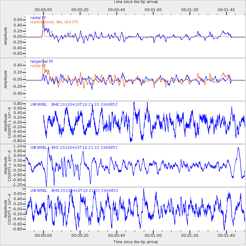
MRBL Marblemount, WA, USA - Earthquake Result Viewer
*The percent match for this event was below the threshold and hence no stack was calculated.
| Earthquake location: |
Honduras |
| Earthquake latitude/longitude: |
15.5/-87.2 |
| Earthquake time(UTC): |
2013/04/10 (100) 19:14:01 GMT |
| Earthquake Depth: |
3.5 km |
| Earthquake Magnitude: |
5.5 MW |
| Earthquake Catalog/Contributor: |
NEIC PDE/NEIC PDE-W |
|
| Network: |
UW Pacific Northwest Regional Seismic Network |
| Station: |
MRBL Marblemount, WA, USA |
| Lat/Lon: |
48.52 N/121.48 W |
| Elevation: |
75 m |
|
| Distance: |
43.3 deg |
| Az: |
326.851 deg |
| Baz: |
127.55 deg |
| Ray Param: |
$rayparam |
*The percent match for this event was below the threshold and hence was not used in the summary stack. |
|
| Radial Match: |
70.66628 % |
| Radial Bump: |
400 |
| Transverse Match: |
54.83671 % |
| Transverse Bump: |
400 |
| SOD ConfigId: |
512894 |
| Insert Time: |
2013-09-13 04:12:42.786 +0000 |
| GWidth: |
2.5 |
| Max Bumps: |
400 |
| Tol: |
0.001 |
|
Signal To Noise
| Channel | StoN | STA | LTA |
| UW:MRBL: :BHZ:20130410T19:21:33.399985Z | 2.0322027 | 6.278457E-7 | 3.0894833E-7 |
| UW:MRBL: :BHN:20130410T19:21:33.399985Z | 0.9417513 | 2.7460058E-7 | 2.9158502E-7 |
| UW:MRBL: :BHE:20130410T19:21:33.399985Z | 1.142486 | 3.3940233E-7 | 2.970735E-7 |
| Arrivals |
| Ps | |
| PpPs | |
| PsPs/PpSs | |


