You are here: Home > Network List > WY - Yellowstone Wyoming Seismic Network Stations List
> Station YPP Pitchstone Plateau, YNP, WY, USA > Earthquake Result Viewer
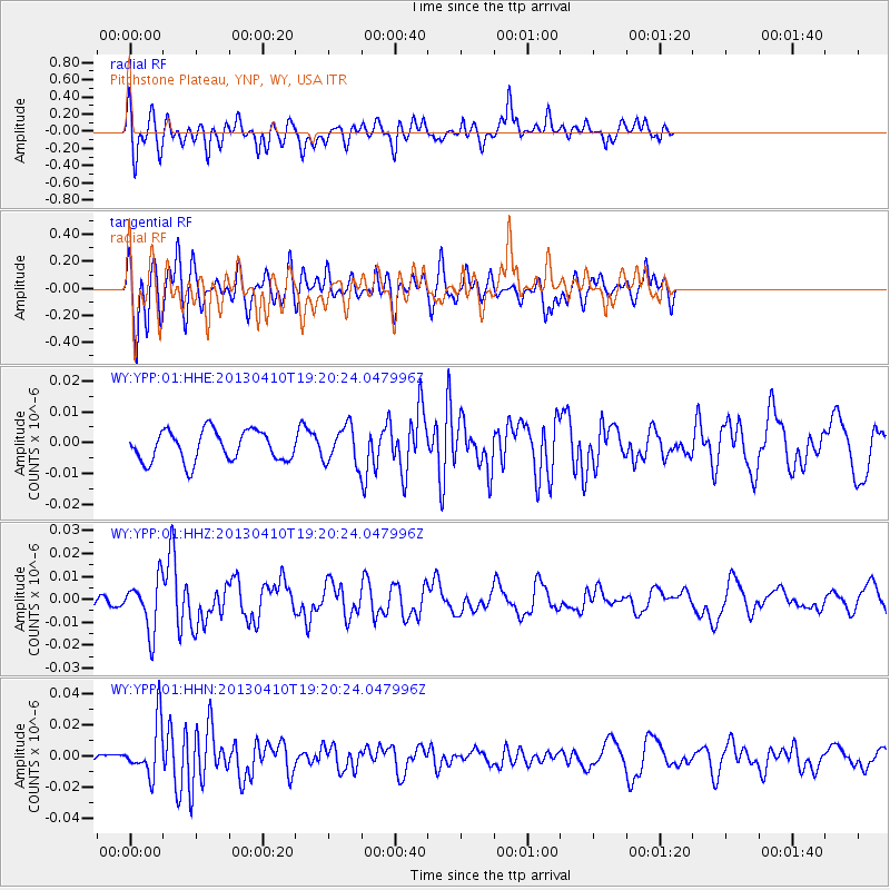
YPP Pitchstone Plateau, YNP, WY, USA - Earthquake Result Viewer
*The percent match for this event was below the threshold and hence no stack was calculated.
| Earthquake location: |
Honduras |
| Earthquake latitude/longitude: |
15.5/-87.2 |
| Earthquake time(UTC): |
2013/04/10 (100) 19:14:01 GMT |
| Earthquake Depth: |
3.5 km |
| Earthquake Magnitude: |
5.5 MW |
| Earthquake Catalog/Contributor: |
NEIC PDE/NEIC PDE-W |
|
| Network: |
WY Yellowstone Wyoming Seismic Network |
| Station: |
YPP Pitchstone Plateau, YNP, WY, USA |
| Lat/Lon: |
44.27 N/110.80 W |
| Elevation: |
2707 m |
|
| Distance: |
35.0 deg |
| Az: |
329.828 deg |
| Baz: |
137.59 deg |
| Ray Param: |
$rayparam |
*The percent match for this event was below the threshold and hence was not used in the summary stack. |
|
| Radial Match: |
61.690258 % |
| Radial Bump: |
400 |
| Transverse Match: |
62.171825 % |
| Transverse Bump: |
400 |
| SOD ConfigId: |
512894 |
| Insert Time: |
2013-09-13 04:14:02.932 +0000 |
| GWidth: |
2.5 |
| Max Bumps: |
400 |
| Tol: |
0.001 |
|
Signal To Noise
| Channel | StoN | STA | LTA |
| WY:YPP:01:HHZ:20130410T19:20:24.047996Z | 2.4900832 | 1.1128031E-8 | 4.4689394E-9 |
| WY:YPP:01:HHN:20130410T19:20:24.047996Z | 5.5080667 | 1.7161325E-8 | 3.1156713E-9 |
| WY:YPP:01:HHE:20130410T19:20:24.047996Z | 1.2047868 | 5.9420153E-9 | 4.932006E-9 |
| Arrivals |
| Ps | |
| PpPs | |
| PsPs/PpSs | |


