You are here: Home > Network List > CN - Canadian National Seismograph Network Stations List
> Station INK INUVIK, NT > Earthquake Result Viewer
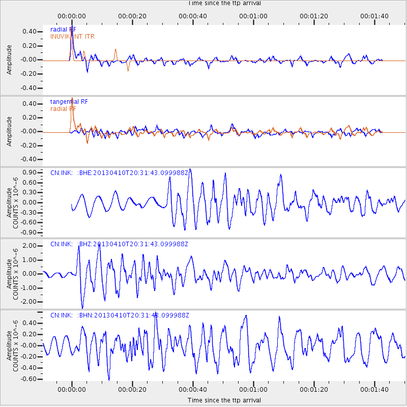
INK INUVIK, NT - Earthquake Result Viewer
*The percent match for this event was below the threshold and hence no stack was calculated.
| Earthquake location: |
Philippine Islands Region |
| Earthquake latitude/longitude: |
20.7/122.1 |
| Earthquake time(UTC): |
2013/04/10 (100) 20:20:26 GMT |
| Earthquake Depth: |
12 km |
| Earthquake Magnitude: |
5.8 MW, 5.7 MS, 5.9 MW, 6.0 MB |
| Earthquake Catalog/Contributor: |
NEIC PDE/NEIC PDE-W |
|
| Network: |
CN Canadian National Seismograph Network |
| Station: |
INK INUVIK, NT |
| Lat/Lon: |
68.31 N/133.53 W |
| Elevation: |
44 m |
|
| Distance: |
76.1 deg |
| Az: |
21.773 deg |
| Baz: |
290.946 deg |
| Ray Param: |
$rayparam |
*The percent match for this event was below the threshold and hence was not used in the summary stack. |
|
| Radial Match: |
79.39529 % |
| Radial Bump: |
360 |
| Transverse Match: |
70.287445 % |
| Transverse Bump: |
400 |
| SOD ConfigId: |
512894 |
| Insert Time: |
2013-09-13 04:23:10.917 +0000 |
| GWidth: |
2.5 |
| Max Bumps: |
400 |
| Tol: |
0.001 |
|
Signal To Noise
| Channel | StoN | STA | LTA |
| CN:INK: :BHZ:20130410T20:31:43.099988Z | 5.691331 | 1.1390799E-6 | 2.0014298E-7 |
| CN:INK: :BHN:20130410T20:31:43.099988Z | 1.4721602 | 1.7339677E-7 | 1.17783905E-7 |
| CN:INK: :BHE:20130410T20:31:43.099988Z | 2.1661925 | 3.860148E-7 | 1.7819967E-7 |
| Arrivals |
| Ps | |
| PpPs | |
| PsPs/PpSs | |


