
ONI Oni, Georgia - Earthquake Result Viewer
| ||||||||||||||||||
| ||||||||||||||||||
| ||||||||||||||||||
|
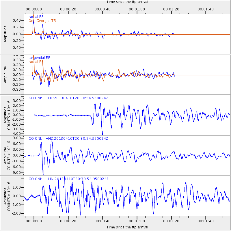
Signal To Noise
| Channel | StoN | STA | LTA |
| GO:ONI: :HHZ:20130410T20:30:54.950024Z | 19.200201 | 2.4068531E-6 | 1.2535563E-7 |
| GO:ONI: :HHN:20130410T20:30:54.950024Z | 2.7960062 | 2.740667E-7 | 9.802078E-8 |
| GO:ONI: :HHE:20130410T20:30:54.950024Z | 8.0960655 | 7.112559E-7 | 8.7852044E-8 |
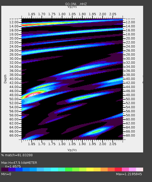
| Arrivals | |
| Ps | 5.2 SECOND |
| PpPs | 19 SECOND |
| PsPs/PpSs | 25 SECOND |

