You are here: Home > Network List > II - Global Seismograph Network (GSN - IRIS/IDA) Stations List
> Station WRAB Tennant Creek, NT, Australia > Earthquake Result Viewer
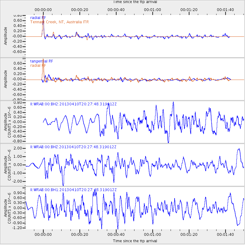
WRAB Tennant Creek, NT, Australia - Earthquake Result Viewer
*The percent match for this event was below the threshold and hence no stack was calculated.
| Earthquake location: |
Philippine Islands Region |
| Earthquake latitude/longitude: |
20.7/122.1 |
| Earthquake time(UTC): |
2013/04/10 (100) 20:20:26 GMT |
| Earthquake Depth: |
12 km |
| Earthquake Magnitude: |
5.8 MW, 5.7 MS, 5.9 MW, 6.0 MB |
| Earthquake Catalog/Contributor: |
NEIC PDE/NEIC PDE-W |
|
| Network: |
II Global Seismograph Network (GSN - IRIS/IDA) |
| Station: |
WRAB Tennant Creek, NT, Australia |
| Lat/Lon: |
19.93 S/134.36 E |
| Elevation: |
366 m |
|
| Distance: |
42.2 deg |
| Az: |
162.632 deg |
| Baz: |
342.722 deg |
| Ray Param: |
$rayparam |
*The percent match for this event was below the threshold and hence was not used in the summary stack. |
|
| Radial Match: |
73.71052 % |
| Radial Bump: |
318 |
| Transverse Match: |
58.16419 % |
| Transverse Bump: |
400 |
| SOD ConfigId: |
512894 |
| Insert Time: |
2013-09-13 04:28:13.470 +0000 |
| GWidth: |
2.5 |
| Max Bumps: |
400 |
| Tol: |
0.001 |
|
Signal To Noise
| Channel | StoN | STA | LTA |
| II:WRAB:00:BHZ:20130410T20:27:48.319012Z | 4.015994 | 7.86231E-7 | 1.9577494E-7 |
| II:WRAB:00:BH1:20130410T20:27:48.319012Z | 1.5736475 | 4.172727E-7 | 2.6516275E-7 |
| II:WRAB:00:BH2:20130410T20:27:48.319012Z | 1.7891922 | 3.4288422E-7 | 1.9164192E-7 |
| Arrivals |
| Ps | |
| PpPs | |
| PsPs/PpSs | |


