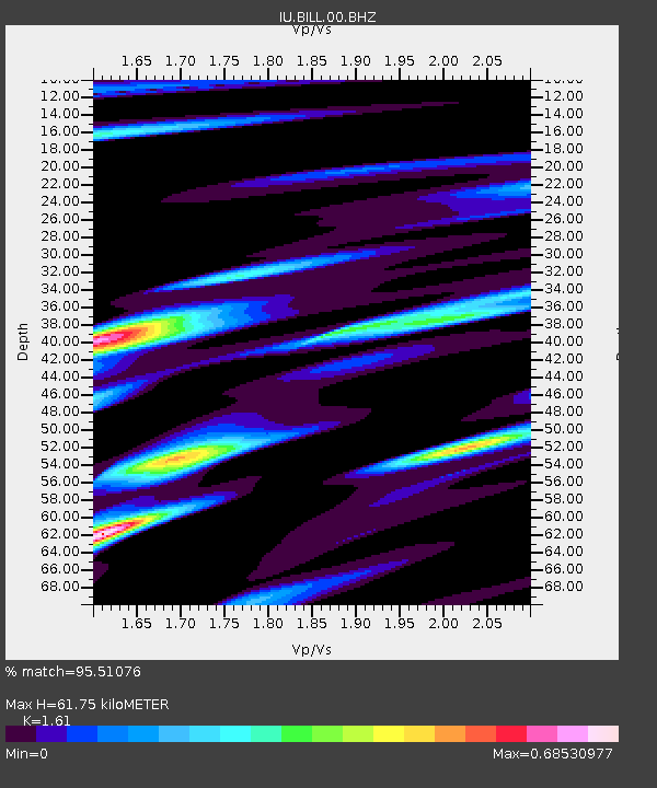
BILL Bilibino, Russia - Earthquake Result Viewer

Earthquake location: Philippine Islands Region
Earthquake latitude/longitude: 20.7/122.1
Earthquake time(UTC): 2013/04/10 (100) 20:20:26 GMT
Earthquake Depth: 12 km
Earthquake Magnitude: 5.8 MW, 5.7 MS, 5.9 MW, 6.0 MB
Earthquake Catalog/Contributor: NEIC PDE/NEIC PDE-W
Network: IU Global Seismograph Network (GSN - IRIS/USGS)
Station: BILL Bilibino, Russia
Lat/Lon: 68.07 N/166.45 E
Elevation: 320 m
Distance: 54.7 deg
Az: 18.777 deg
Baz: 233.318 deg
Ray Param: 0.06525546
Estimated Moho Depth: 61.75 km
Estimated Crust Vp/Vs: 1.61
Assumed Crust Vp: 6.577 km/s
Estimated Crust Vs: 4.085 km/s
Estimated Crust Poisson's Ratio: 0.19
Radial Match: 95.51076 %
Radial Bump: 394
Transverse Match: 88.76276 %
Transverse Bump: 400
SOD ConfigId: 512894
Insert Time: 2013-09-13 04:28:27.957 +0000
GWidth: 2.5
Max Bumps: 400
Tol: 0.001

Signal To Noise

ChannelStoNSTALTA
IU:BILL:00:BHZ:20130410T20:29:25.047986Z18.739441.552325E-68.283732E-8
IU:BILL:00:BHN:20130410T20:29:25.047986Z11.4818227.8569917E-76.842983E-8
IU:BILL:00:BHE:20130410T20:29:25.047986Z9.3351526.32342E-76.773774E-8
Arrivals
Ps6.1 SECOND
PpPs23 SECOND
PsPs/PpSs29 SECOND