You are here: Home > Network List > TA - USArray Transportable Network (new EarthScope stations) Stations List
> Station L04D Klamath Falls, OR, USA > Earthquake Result Viewer
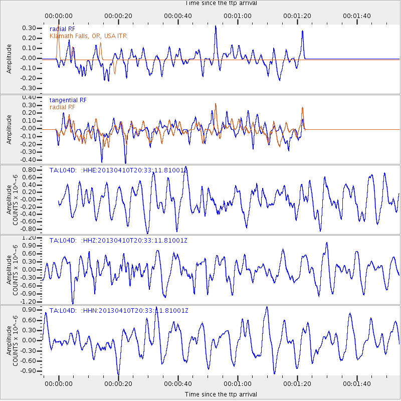
L04D Klamath Falls, OR, USA - Earthquake Result Viewer
*The percent match for this event was below the threshold and hence no stack was calculated.
| Earthquake location: |
Philippine Islands Region |
| Earthquake latitude/longitude: |
20.7/122.1 |
| Earthquake time(UTC): |
2013/04/10 (100) 20:20:26 GMT |
| Earthquake Depth: |
12 km |
| Earthquake Magnitude: |
5.8 MW, 5.7 MS, 5.9 MW, 6.0 MB |
| Earthquake Catalog/Contributor: |
NEIC PDE/NEIC PDE-W |
|
| Network: |
TA USArray Transportable Network (new EarthScope stations) |
| Station: |
L04D Klamath Falls, OR, USA |
| Lat/Lon: |
42.22 N/122.30 W |
| Elevation: |
1437 m |
|
| Distance: |
93.7 deg |
| Az: |
42.157 deg |
| Baz: |
302.244 deg |
| Ray Param: |
$rayparam |
*The percent match for this event was below the threshold and hence was not used in the summary stack. |
|
| Radial Match: |
61.419422 % |
| Radial Bump: |
400 |
| Transverse Match: |
71.88103 % |
| Transverse Bump: |
400 |
| SOD ConfigId: |
512894 |
| Insert Time: |
2013-09-13 04:34:57.840 +0000 |
| GWidth: |
2.5 |
| Max Bumps: |
400 |
| Tol: |
0.001 |
|
Signal To Noise
| Channel | StoN | STA | LTA |
| TA:L04D: :HHZ:20130410T20:33:11.81001Z | 2.305682 | 4.5774823E-7 | 1.9853051E-7 |
| TA:L04D: :HHN:20130410T20:33:11.81001Z | 0.2937451 | 1.2295645E-7 | 4.1858212E-7 |
| TA:L04D: :HHE:20130410T20:33:11.81001Z | 1.6998235 | 5.10431E-7 | 3.0028468E-7 |
| Arrivals |
| Ps | |
| PpPs | |
| PsPs/PpSs | |


