You are here: Home > Network List > GS - US Geological Survey Networks Stations List
> Station KAN10 Keim Farm > Earthquake Result Viewer
KAN10 Keim Farm - Earthquake Result Viewer
*The percent match for this event was below the threshold and hence no stack was calculated.
| Earthquake location: |
Southeastern Alaska |
| Earthquake latitude/longitude: |
60.4/-140.3 |
| Earthquake time(UTC): |
2014/07/17 (198) 11:49:32 GMT |
| Earthquake Depth: |
0.6 km |
| Earthquake Magnitude: |
5.8 MI |
| Earthquake Catalog/Contributor: |
NEIC PDE/NEIC ALERT |
|
| Network: |
GS US Geological Survey Networks |
| Station: |
KAN10 Keim Farm |
| Lat/Lon: |
37.12 N/98.10 W |
| Elevation: |
417 m |
|
| Distance: |
35.4 deg |
| Az: |
111.792 deg |
| Baz: |
324.746 deg |
| Ray Param: |
$rayparam |
*The percent match for this event was below the threshold and hence was not used in the summary stack. |
|
| Radial Match: |
35.692665 % |
| Radial Bump: |
400 |
| Transverse Match: |
18.673609 % |
| Transverse Bump: |
400 |
| SOD ConfigId: |
3390531 |
| Insert Time: |
2019-04-12 21:58:43.991 +0000 |
| GWidth: |
2.5 |
| Max Bumps: |
400 |
| Tol: |
0.001 |
|
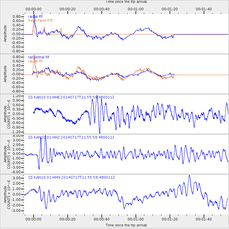
Signal To Noise
| Channel | StoN | STA | LTA |
| GS:KAN10:01:HHZ:20140717T11:55:58.480011Z | 15.590076 | 1.4925112E-6 | 9.573469E-8 |
| GS:KAN10:01:HHN:20140717T11:55:58.480011Z | 5.618951 | 1.3312697E-6 | 2.3692495E-7 |
| GS:KAN10:01:HHE:20140717T11:55:58.480011Z | 1.235807 | 3.8961662E-7 | 3.1527304E-7 |
| Arrivals |
| Ps | |
| PpPs | |
| PsPs/PpSs | |


