You are here: Home > Network List > AZ - ANZA Regional Network Stations List
> Station SMER AZ.SMER > Earthquake Result Viewer
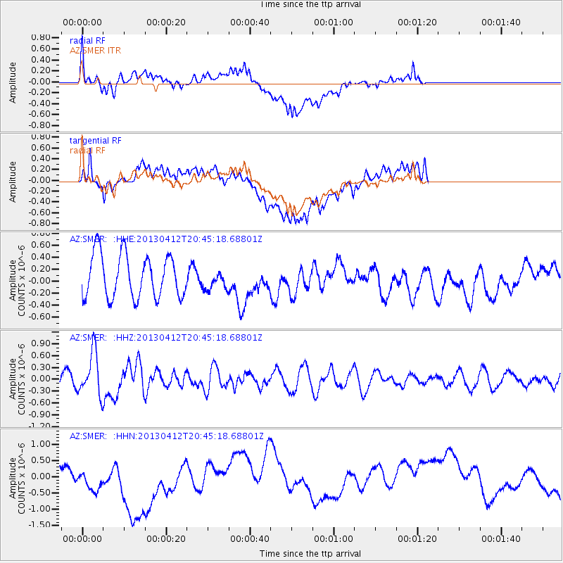
SMER AZ.SMER - Earthquake Result Viewer
*The percent match for this event was below the threshold and hence no stack was calculated.
| Earthquake location: |
Near S. Coast Of Western Honshu |
| Earthquake latitude/longitude: |
34.4/134.8 |
| Earthquake time(UTC): |
2013/04/12 (102) 20:33:17 GMT |
| Earthquake Depth: |
14 km |
| Earthquake Magnitude: |
5.8 MW, 5.5 MS, 5.7 MB, 5.8 MW |
| Earthquake Catalog/Contributor: |
NEIC PDE/NEIC PDE-W |
|
| Network: |
AZ ANZA Regional Network |
| Station: |
SMER AZ.SMER |
| Lat/Lon: |
33.46 N/117.17 W |
| Elevation: |
355 m |
|
| Distance: |
84.6 deg |
| Az: |
53.002 deg |
| Baz: |
307.792 deg |
| Ray Param: |
$rayparam |
*The percent match for this event was below the threshold and hence was not used in the summary stack. |
|
| Radial Match: |
51.193127 % |
| Radial Bump: |
400 |
| Transverse Match: |
38.56701 % |
| Transverse Bump: |
400 |
| SOD ConfigId: |
512894 |
| Insert Time: |
2013-09-13 05:20:09.732 +0000 |
| GWidth: |
2.5 |
| Max Bumps: |
400 |
| Tol: |
0.001 |
|
Signal To Noise
| Channel | StoN | STA | LTA |
| AZ:SMER: :HHZ:20130412T20:45:18.68801Z | 2.5445092 | 5.534432E-7 | 2.1750492E-7 |
| AZ:SMER: :HHN:20130412T20:45:18.68801Z | 1.8590068 | 7.8266106E-7 | 4.2101036E-7 |
| AZ:SMER: :HHE:20130412T20:45:18.68801Z | 0.4494539 | 1.6148246E-7 | 3.5928593E-7 |
| Arrivals |
| Ps | |
| PpPs | |
| PsPs/PpSs | |


