You are here: Home > Network List > NI - North-East Italy Broadband Network Stations List
> Station CGRP Cima Grappa > Earthquake Result Viewer
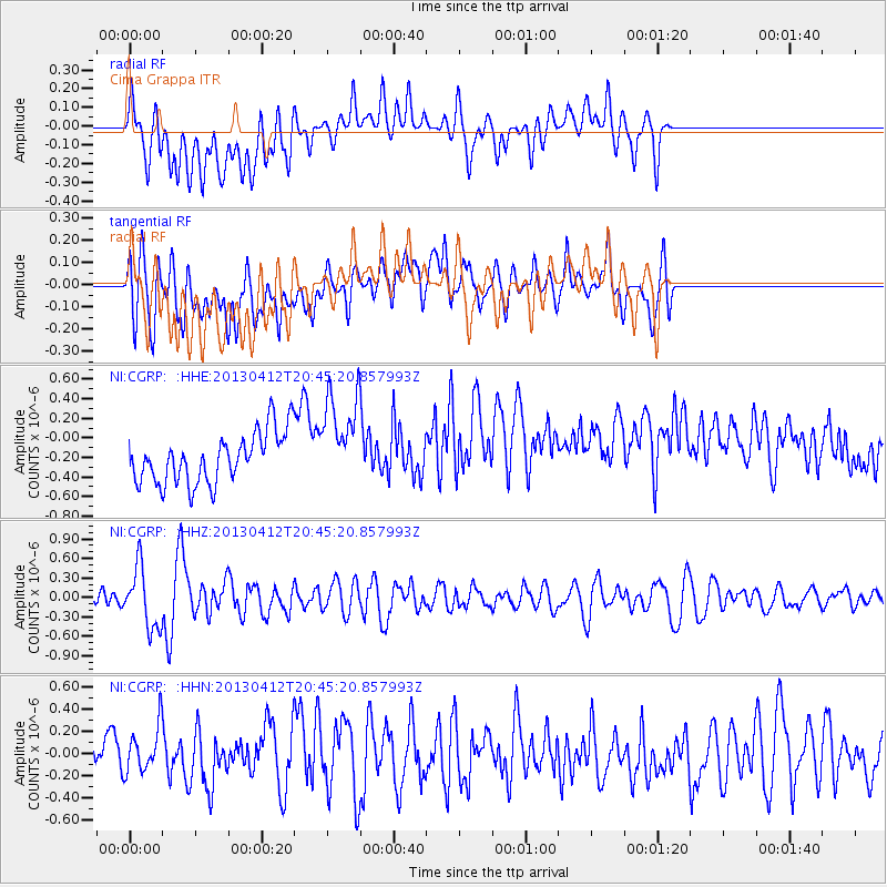
CGRP Cima Grappa - Earthquake Result Viewer
*The percent match for this event was below the threshold and hence no stack was calculated.
| Earthquake location: |
Near S. Coast Of Western Honshu |
| Earthquake latitude/longitude: |
34.4/134.8 |
| Earthquake time(UTC): |
2013/04/12 (102) 20:33:17 GMT |
| Earthquake Depth: |
14 km |
| Earthquake Magnitude: |
5.8 MW, 5.5 MS, 5.7 MB, 5.8 MW |
| Earthquake Catalog/Contributor: |
NEIC PDE/NEIC PDE-W |
|
| Network: |
NI North-East Italy Broadband Network |
| Station: |
CGRP Cima Grappa |
| Lat/Lon: |
45.88 N/11.80 E |
| Elevation: |
1757 m |
|
| Distance: |
85.0 deg |
| Az: |
323.989 deg |
| Baz: |
44.123 deg |
| Ray Param: |
$rayparam |
*The percent match for this event was below the threshold and hence was not used in the summary stack. |
|
| Radial Match: |
48.9481 % |
| Radial Bump: |
400 |
| Transverse Match: |
52.189896 % |
| Transverse Bump: |
400 |
| SOD ConfigId: |
512894 |
| Insert Time: |
2013-09-13 05:35:02.654 +0000 |
| GWidth: |
2.5 |
| Max Bumps: |
400 |
| Tol: |
0.001 |
|
Signal To Noise
| Channel | StoN | STA | LTA |
| NI:CGRP: :HHZ:20130412T20:45:20.857993Z | 5.100459 | 4.6248906E-7 | 9.067596E-8 |
| NI:CGRP: :HHN:20130412T20:45:20.857993Z | 1.2355419 | 2.1347859E-7 | 1.7278134E-7 |
| NI:CGRP: :HHE:20130412T20:45:20.857993Z | 1.8581054 | 4.786666E-7 | 2.5761005E-7 |
| Arrivals |
| Ps | |
| PpPs | |
| PsPs/PpSs | |


