You are here: Home > Network List > TA - USArray Transportable Network (new EarthScope stations) Stations List
> Station E38A The Farm, Brule, WI, USA > Earthquake Result Viewer
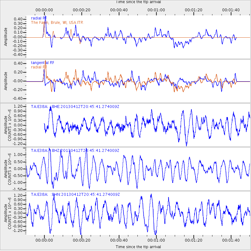
E38A The Farm, Brule, WI, USA - Earthquake Result Viewer
*The percent match for this event was below the threshold and hence no stack was calculated.
| Earthquake location: |
Near S. Coast Of Western Honshu |
| Earthquake latitude/longitude: |
34.4/134.8 |
| Earthquake time(UTC): |
2013/04/12 (102) 20:33:17 GMT |
| Earthquake Depth: |
14 km |
| Earthquake Magnitude: |
5.8 MW, 5.5 MS, 5.7 MB, 5.8 MW |
| Earthquake Catalog/Contributor: |
NEIC PDE/NEIC PDE-W |
|
| Network: |
TA USArray Transportable Network (new EarthScope stations) |
| Station: |
E38A The Farm, Brule, WI, USA |
| Lat/Lon: |
46.61 N/91.55 W |
| Elevation: |
341 m |
|
| Distance: |
89.2 deg |
| Az: |
29.946 deg |
| Baz: |
323.209 deg |
| Ray Param: |
$rayparam |
*The percent match for this event was below the threshold and hence was not used in the summary stack. |
|
| Radial Match: |
60.148525 % |
| Radial Bump: |
400 |
| Transverse Match: |
56.05756 % |
| Transverse Bump: |
400 |
| SOD ConfigId: |
512894 |
| Insert Time: |
2013-09-13 05:41:36.051 +0000 |
| GWidth: |
2.5 |
| Max Bumps: |
400 |
| Tol: |
0.001 |
|
Signal To Noise
| Channel | StoN | STA | LTA |
| TA:E38A: :BHZ:20130412T20:45:41.274009Z | 2.2627947 | 8.8105077E-7 | 3.8936398E-7 |
| TA:E38A: :BHN:20130412T20:45:41.274009Z | 1.5950594 | 6.891202E-7 | 4.320342E-7 |
| TA:E38A: :BHE:20130412T20:45:41.274009Z | 0.88200873 | 3.3239934E-7 | 3.7686627E-7 |
| Arrivals |
| Ps | |
| PpPs | |
| PsPs/PpSs | |


