You are here: Home > Network List > US - United States National Seismic Network Stations List
> Station ELK Elko, Nevada, USA > Earthquake Result Viewer
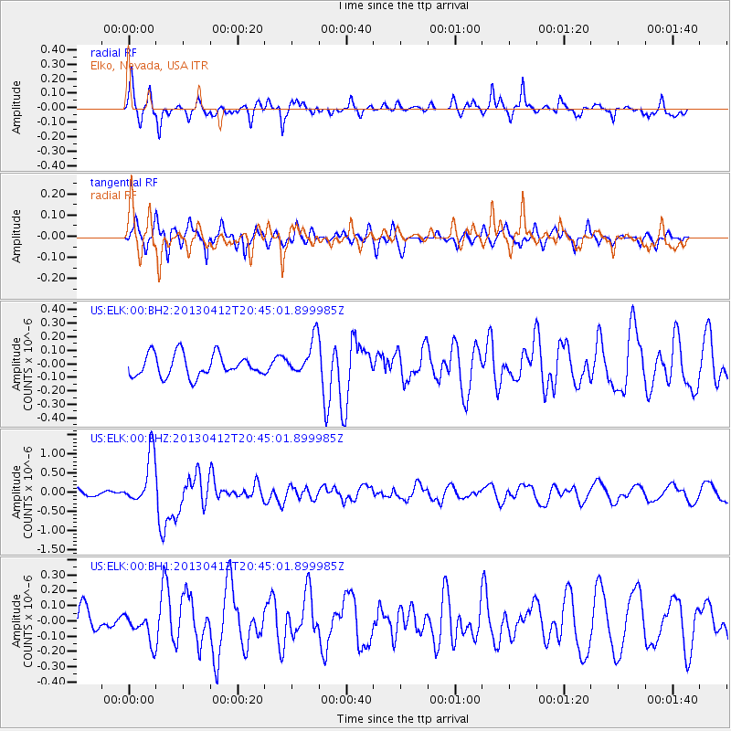
ELK Elko, Nevada, USA - Earthquake Result Viewer
*The percent match for this event was below the threshold and hence no stack was calculated.
| Earthquake location: |
Near S. Coast Of Western Honshu |
| Earthquake latitude/longitude: |
34.4/134.8 |
| Earthquake time(UTC): |
2013/04/12 (102) 20:33:17 GMT |
| Earthquake Depth: |
14 km |
| Earthquake Magnitude: |
5.8 MW, 5.5 MS, 5.7 MB, 5.8 MW |
| Earthquake Catalog/Contributor: |
NEIC PDE/NEIC PDE-W |
|
| Network: |
US United States National Seismic Network |
| Station: |
ELK Elko, Nevada, USA |
| Lat/Lon: |
40.74 N/115.24 W |
| Elevation: |
2210 m |
|
| Distance: |
81.3 deg |
| Az: |
46.267 deg |
| Baz: |
308.126 deg |
| Ray Param: |
$rayparam |
*The percent match for this event was below the threshold and hence was not used in the summary stack. |
|
| Radial Match: |
69.42472 % |
| Radial Bump: |
370 |
| Transverse Match: |
62.287 % |
| Transverse Bump: |
400 |
| SOD ConfigId: |
512894 |
| Insert Time: |
2013-09-13 05:52:26.495 +0000 |
| GWidth: |
2.5 |
| Max Bumps: |
400 |
| Tol: |
0.001 |
|
Signal To Noise
| Channel | StoN | STA | LTA |
| US:ELK:00:BHZ:20130412T20:45:01.899985Z | 6.0882535 | 6.658108E-7 | 1.09359895E-7 |
| US:ELK:00:BH1:20130412T20:45:01.899985Z | 1.0429713 | 9.054884E-8 | 8.681815E-8 |
| US:ELK:00:BH2:20130412T20:45:01.899985Z | 1.6977432 | 1.3782889E-7 | 8.118359E-8 |
| Arrivals |
| Ps | |
| PpPs | |
| PsPs/PpSs | |


