You are here: Home > Network List > UU - University of Utah Regional Network Stations List
> Station KNB Kanab, UT, USA > Earthquake Result Viewer
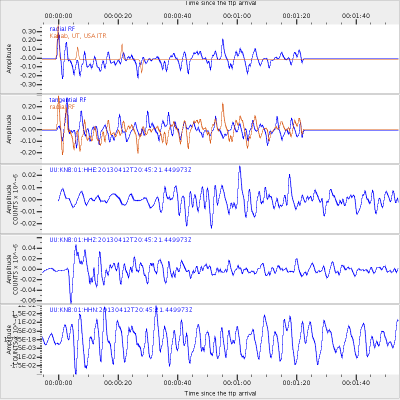
KNB Kanab, UT, USA - Earthquake Result Viewer
*The percent match for this event was below the threshold and hence no stack was calculated.
| Earthquake location: |
Near S. Coast Of Western Honshu |
| Earthquake latitude/longitude: |
34.4/134.8 |
| Earthquake time(UTC): |
2013/04/12 (102) 20:33:17 GMT |
| Earthquake Depth: |
14 km |
| Earthquake Magnitude: |
5.8 MW, 5.5 MS, 5.7 MB, 5.8 MW |
| Earthquake Catalog/Contributor: |
NEIC PDE/NEIC PDE-W |
|
| Network: |
UU University of Utah Regional Network |
| Station: |
KNB Kanab, UT, USA |
| Lat/Lon: |
37.02 N/112.82 W |
| Elevation: |
1715 m |
|
| Distance: |
85.1 deg |
| Az: |
47.985 deg |
| Baz: |
309.841 deg |
| Ray Param: |
$rayparam |
*The percent match for this event was below the threshold and hence was not used in the summary stack. |
|
| Radial Match: |
73.28528 % |
| Radial Bump: |
400 |
| Transverse Match: |
61.74638 % |
| Transverse Bump: |
384 |
| SOD ConfigId: |
512894 |
| Insert Time: |
2013-09-13 05:54:28.031 +0000 |
| GWidth: |
2.5 |
| Max Bumps: |
400 |
| Tol: |
0.001 |
|
Signal To Noise
| Channel | StoN | STA | LTA |
| UU:KNB:01:HHZ:20130412T20:45:21.449973Z | 8.774787 | 2.1853229E-8 | 2.4904567E-9 |
| UU:KNB:01:HHN:20130412T20:45:21.449973Z | 1.1530322 | 6.071251E-9 | 5.265466E-9 |
| UU:KNB:01:HHE:20130412T20:45:21.449973Z | 1.5766716 | 5.400744E-9 | 3.4254082E-9 |
| Arrivals |
| Ps | |
| PpPs | |
| PsPs/PpSs | |


