You are here: Home > Network List > WY - Yellowstone Wyoming Seismic Network Stations List
> Station YNR Norris Junction, YNP, WY, USA > Earthquake Result Viewer
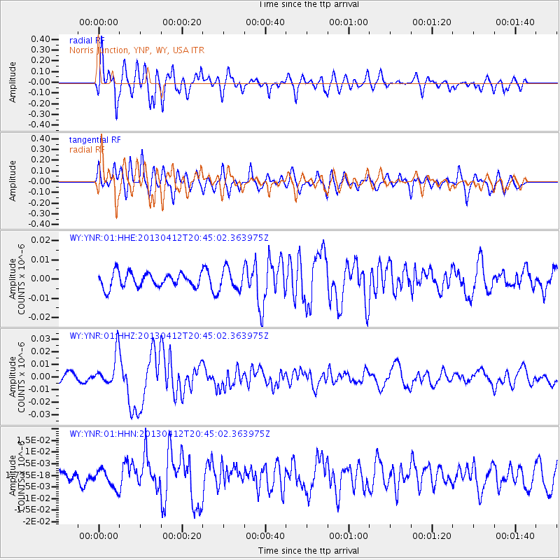
YNR Norris Junction, YNP, WY, USA - Earthquake Result Viewer
*The percent match for this event was below the threshold and hence no stack was calculated.
| Earthquake location: |
Near S. Coast Of Western Honshu |
| Earthquake latitude/longitude: |
34.4/134.8 |
| Earthquake time(UTC): |
2013/04/12 (102) 20:33:17 GMT |
| Earthquake Depth: |
14 km |
| Earthquake Magnitude: |
5.8 MW, 5.5 MS, 5.7 MB, 5.8 MW |
| Earthquake Catalog/Contributor: |
NEIC PDE/NEIC PDE-W |
|
| Network: |
WY Yellowstone Wyoming Seismic Network |
| Station: |
YNR Norris Junction, YNP, WY, USA |
| Lat/Lon: |
44.72 N/110.68 W |
| Elevation: |
2336 m |
|
| Distance: |
81.4 deg |
| Az: |
41.01 deg |
| Baz: |
310.421 deg |
| Ray Param: |
$rayparam |
*The percent match for this event was below the threshold and hence was not used in the summary stack. |
|
| Radial Match: |
71.73125 % |
| Radial Bump: |
400 |
| Transverse Match: |
62.20796 % |
| Transverse Bump: |
400 |
| SOD ConfigId: |
512894 |
| Insert Time: |
2013-09-13 05:58:30.242 +0000 |
| GWidth: |
2.5 |
| Max Bumps: |
400 |
| Tol: |
0.001 |
|
Signal To Noise
| Channel | StoN | STA | LTA |
| WY:YNR:01:HHZ:20130412T20:45:02.363975Z | 2.66127 | 1.3461769E-8 | 5.0584004E-9 |
| WY:YNR:01:HHN:20130412T20:45:02.363975Z | 0.9409141 | 4.1123904E-9 | 4.3706336E-9 |
| WY:YNR:01:HHE:20130412T20:45:02.363975Z | 1.4581381 | 5.32664E-9 | 3.653042E-9 |
| Arrivals |
| Ps | |
| PpPs | |
| PsPs/PpSs | |


