You are here: Home > Network List > TA - USArray Transportable Network (new EarthScope stations) Stations List
> Station J01E Myrtle Point, OR, USA > Earthquake Result Viewer
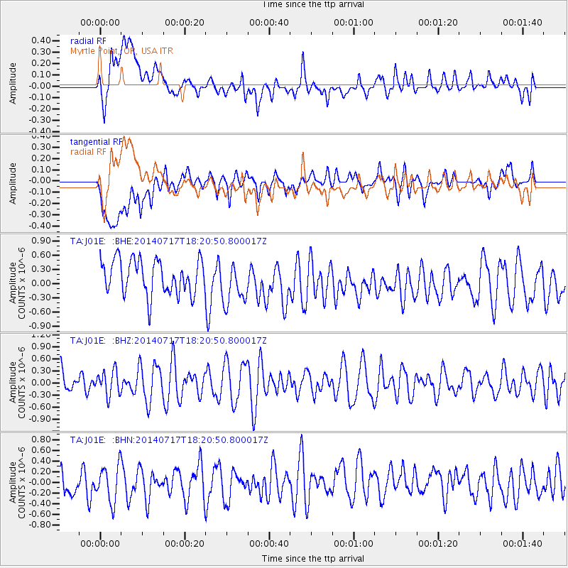
J01E Myrtle Point, OR, USA - Earthquake Result Viewer
*The percent match for this event was below the threshold and hence no stack was calculated.
| Earthquake location: |
Solomon Islands |
| Earthquake latitude/longitude: |
-6.2/154.4 |
| Earthquake time(UTC): |
2014/07/17 (198) 18:08:38 GMT |
| Earthquake Depth: |
64 km |
| Earthquake Magnitude: |
5.4 MW, 5.1 mb |
| Earthquake Catalog/Contributor: |
ISC/ISC |
|
| Network: |
TA USArray Transportable Network (new EarthScope stations) |
| Station: |
J01E Myrtle Point, OR, USA |
| Lat/Lon: |
43.16 N/123.93 W |
| Elevation: |
128 m |
|
| Distance: |
88.2 deg |
| Az: |
46.424 deg |
| Baz: |
259.884 deg |
| Ray Param: |
$rayparam |
*The percent match for this event was below the threshold and hence was not used in the summary stack. |
|
| Radial Match: |
50.916515 % |
| Radial Bump: |
400 |
| Transverse Match: |
41.60657 % |
| Transverse Bump: |
400 |
| SOD ConfigId: |
3390531 |
| Insert Time: |
2019-04-12 22:11:49.639 +0000 |
| GWidth: |
2.5 |
| Max Bumps: |
400 |
| Tol: |
0.001 |
|
Signal To Noise
| Channel | StoN | STA | LTA |
| TA:J01E: :BHZ:20140717T18:20:50.800017Z | 1.039846 | 3.1099205E-7 | 2.990751E-7 |
| TA:J01E: :BHN:20140717T18:20:50.800017Z | 1.2618359 | 3.8514813E-7 | 3.0522835E-7 |
| TA:J01E: :BHE:20140717T18:20:50.800017Z | 1.2722405 | 4.5947257E-7 | 3.6115227E-7 |
| Arrivals |
| Ps | |
| PpPs | |
| PsPs/PpSs | |


