You are here: Home > Network List > TA - USArray Transportable Network (new EarthScope stations) Stations List
> Station G59A Clarenceville, QC, USA > Earthquake Result Viewer
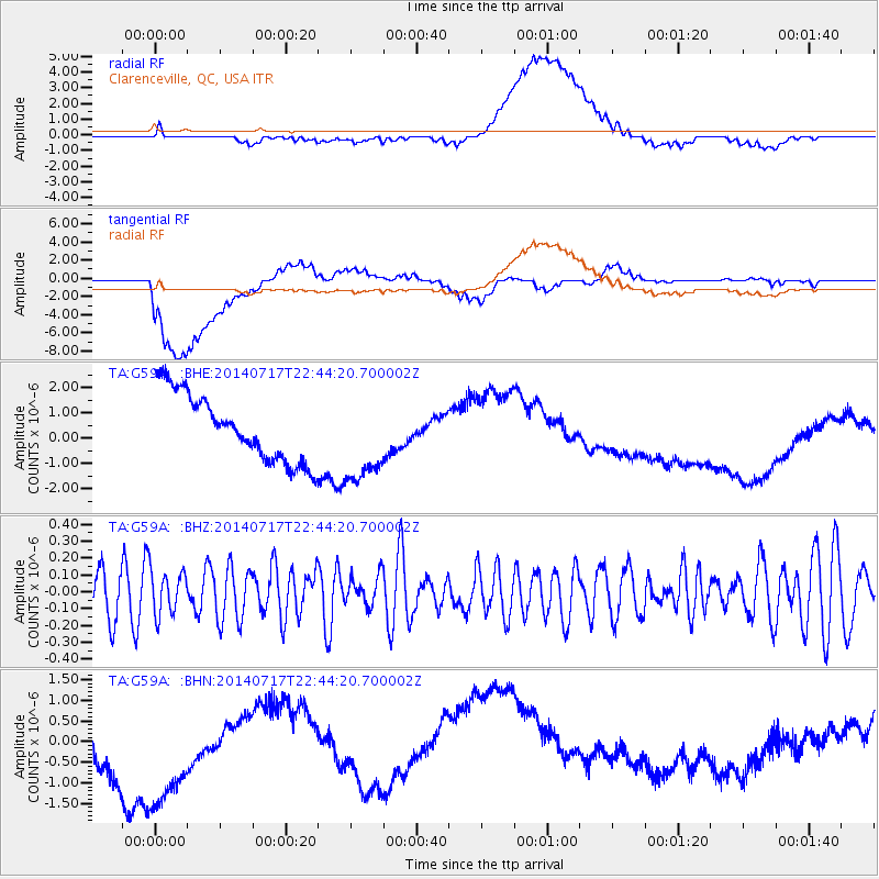
G59A Clarenceville, QC, USA - Earthquake Result Viewer
*The percent match for this event was below the threshold and hence no stack was calculated.
| Earthquake location: |
Kuril Islands |
| Earthquake latitude/longitude: |
46.1/150.7 |
| Earthquake time(UTC): |
2014/07/17 (198) 22:32:46 GMT |
| Earthquake Depth: |
100 km |
| Earthquake Magnitude: |
5.1 MW, 4.9 mb |
| Earthquake Catalog/Contributor: |
ISC/ISC |
|
| Network: |
TA USArray Transportable Network (new EarthScope stations) |
| Station: |
G59A Clarenceville, QC, USA |
| Lat/Lon: |
45.08 N/73.18 W |
| Elevation: |
36 m |
|
| Distance: |
81.3 deg |
| Az: |
29.81 deg |
| Baz: |
330.788 deg |
| Ray Param: |
$rayparam |
*The percent match for this event was below the threshold and hence was not used in the summary stack. |
|
| Radial Match: |
41.861782 % |
| Radial Bump: |
400 |
| Transverse Match: |
39.757423 % |
| Transverse Bump: |
400 |
| SOD ConfigId: |
3390531 |
| Insert Time: |
2019-04-12 22:19:59.737 +0000 |
| GWidth: |
2.5 |
| Max Bumps: |
400 |
| Tol: |
0.001 |
|
Signal To Noise
| Channel | StoN | STA | LTA |
| TA:G59A: :BHZ:20140717T22:44:20.700002Z | 1.0549159 | 1.3207085E-7 | 1.2519563E-7 |
| TA:G59A: :BHN:20140717T22:44:20.700002Z | 2.2664714 | 2.073841E-6 | 9.150086E-7 |
| TA:G59A: :BHE:20140717T22:44:20.700002Z | 1.3217736 | 1.7637676E-6 | 1.3343946E-6 |
| Arrivals |
| Ps | |
| PpPs | |
| PsPs/PpSs | |


