You are here: Home > Network List > TA - USArray Transportable Network (new EarthScope stations) Stations List
> Station H63A New Sharon, ME, USA > Earthquake Result Viewer
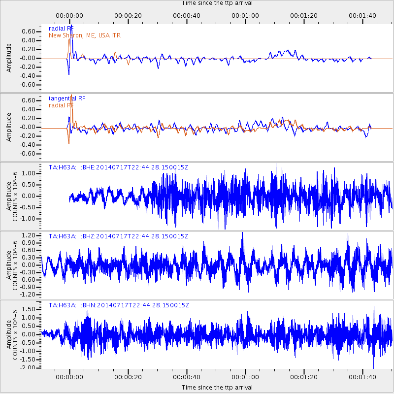
H63A New Sharon, ME, USA - Earthquake Result Viewer
*The percent match for this event was below the threshold and hence no stack was calculated.
| Earthquake location: |
Kuril Islands |
| Earthquake latitude/longitude: |
46.1/150.7 |
| Earthquake time(UTC): |
2014/07/17 (198) 22:32:46 GMT |
| Earthquake Depth: |
100 km |
| Earthquake Magnitude: |
5.1 MW, 4.9 mb |
| Earthquake Catalog/Contributor: |
ISC/ISC |
|
| Network: |
TA USArray Transportable Network (new EarthScope stations) |
| Station: |
H63A New Sharon, ME, USA |
| Lat/Lon: |
44.66 N/70.04 W |
| Elevation: |
109 m |
|
| Distance: |
82.7 deg |
| Az: |
28.02 deg |
| Baz: |
332.75 deg |
| Ray Param: |
$rayparam |
*The percent match for this event was below the threshold and hence was not used in the summary stack. |
|
| Radial Match: |
76.786995 % |
| Radial Bump: |
400 |
| Transverse Match: |
53.45668 % |
| Transverse Bump: |
400 |
| SOD ConfigId: |
3390531 |
| Insert Time: |
2019-04-12 22:20:03.856 +0000 |
| GWidth: |
2.5 |
| Max Bumps: |
400 |
| Tol: |
0.001 |
|
Signal To Noise
| Channel | StoN | STA | LTA |
| TA:H63A: :BHZ:20140717T22:44:28.150015Z | 1.2606119 | 2.4828586E-7 | 1.9695662E-7 |
| TA:H63A: :BHN:20140717T22:44:28.150015Z | 2.751641 | 4.6684067E-7 | 1.6965899E-7 |
| TA:H63A: :BHE:20140717T22:44:28.150015Z | 2.5255053 | 5.042069E-7 | 1.9964594E-7 |
| Arrivals |
| Ps | |
| PpPs | |
| PsPs/PpSs | |


