You are here: Home > Network List > TA - USArray Transportable Network (new EarthScope stations) Stations List
> Station O03E Paynes Creek, CA, USA > Earthquake Result Viewer
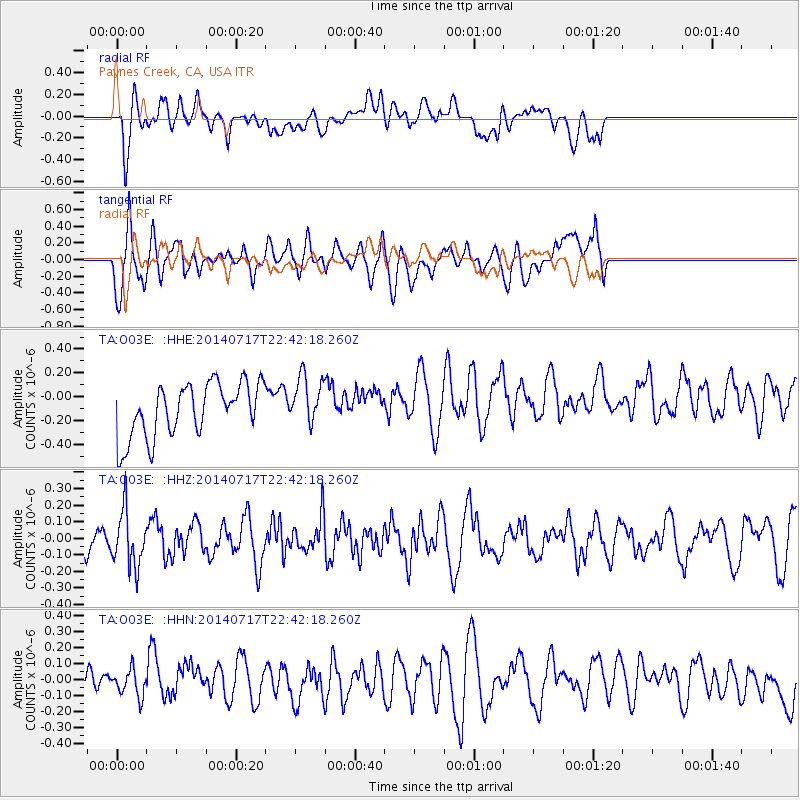
O03E Paynes Creek, CA, USA - Earthquake Result Viewer
*The percent match for this event was below the threshold and hence no stack was calculated.
| Earthquake location: |
Kuril Islands |
| Earthquake latitude/longitude: |
46.1/150.7 |
| Earthquake time(UTC): |
2014/07/17 (198) 22:32:46 GMT |
| Earthquake Depth: |
100 km |
| Earthquake Magnitude: |
5.1 MW, 4.9 mb |
| Earthquake Catalog/Contributor: |
ISC/ISC |
|
| Network: |
TA USArray Transportable Network (new EarthScope stations) |
| Station: |
O03E Paynes Creek, CA, USA |
| Lat/Lon: |
40.29 N/121.80 W |
| Elevation: |
967 m |
|
| Distance: |
60.9 deg |
| Az: |
60.986 deg |
| Baz: |
307.321 deg |
| Ray Param: |
$rayparam |
*The percent match for this event was below the threshold and hence was not used in the summary stack. |
|
| Radial Match: |
53.64023 % |
| Radial Bump: |
400 |
| Transverse Match: |
69.20162 % |
| Transverse Bump: |
400 |
| SOD ConfigId: |
3390531 |
| Insert Time: |
2019-04-12 22:20:23.860 +0000 |
| GWidth: |
2.5 |
| Max Bumps: |
400 |
| Tol: |
0.001 |
|
Signal To Noise
| Channel | StoN | STA | LTA |
| TA:O03E: :HHZ:20140717T22:42:18.260Z | 2.2607145 | 1.6494087E-7 | 7.295962E-8 |
| TA:O03E: :HHN:20140717T22:42:18.260Z | 0.72694635 | 8.2037374E-8 | 1.12852035E-7 |
| TA:O03E: :HHE:20140717T22:42:18.260Z | 0.9068302 | 2.040938E-7 | 2.2506286E-7 |
| Arrivals |
| Ps | |
| PpPs | |
| PsPs/PpSs | |


