You are here: Home > Network List > US - United States National Seismic Network Stations List
> Station AGMN Agassiz National Wildlife Refuge, Minnesota, USA > Earthquake Result Viewer
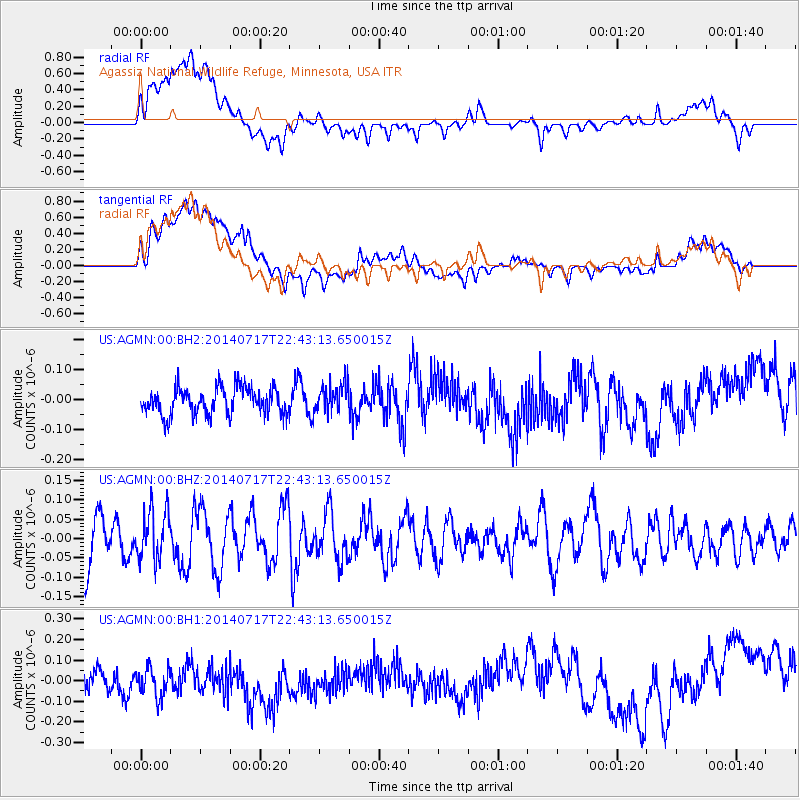
AGMN Agassiz National Wildlife Refuge, Minnesota, USA - Earthquake Result Viewer
*The percent match for this event was below the threshold and hence no stack was calculated.
| Earthquake location: |
Kuril Islands |
| Earthquake latitude/longitude: |
46.1/150.7 |
| Earthquake time(UTC): |
2014/07/17 (198) 22:32:46 GMT |
| Earthquake Depth: |
100 km |
| Earthquake Magnitude: |
5.1 MW, 4.9 mb |
| Earthquake Catalog/Contributor: |
ISC/ISC |
|
| Network: |
US United States National Seismic Network |
| Station: |
AGMN Agassiz National Wildlife Refuge, Minnesota, USA |
| Lat/Lon: |
48.30 N/95.86 W |
| Elevation: |
351 m |
|
| Distance: |
69.5 deg |
| Az: |
40.862 deg |
| Baz: |
317.041 deg |
| Ray Param: |
$rayparam |
*The percent match for this event was below the threshold and hence was not used in the summary stack. |
|
| Radial Match: |
44.185284 % |
| Radial Bump: |
400 |
| Transverse Match: |
48.327053 % |
| Transverse Bump: |
400 |
| SOD ConfigId: |
3390531 |
| Insert Time: |
2019-04-12 22:21:11.328 +0000 |
| GWidth: |
2.5 |
| Max Bumps: |
400 |
| Tol: |
0.001 |
|
Signal To Noise
| Channel | StoN | STA | LTA |
| US:AGMN:00:BHZ:20140717T22:43:13.650015Z | 0.969301 | 6.4278616E-8 | 6.63144E-8 |
| US:AGMN:00:BH1:20140717T22:43:13.650015Z | 1.173482 | 9.3189016E-8 | 7.9412395E-8 |
| US:AGMN:00:BH2:20140717T22:43:13.650015Z | 1.0735573 | 4.788472E-8 | 4.4603784E-8 |
| Arrivals |
| Ps | |
| PpPs | |
| PsPs/PpSs | |


