You are here: Home > Network List > IW - Intermountain West Stations List
> Station MOOW Moose Ponds, Wyoming, USA > Earthquake Result Viewer
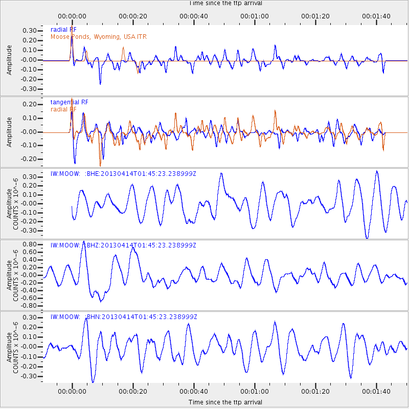
MOOW Moose Ponds, Wyoming, USA - Earthquake Result Viewer
*The percent match for this event was below the threshold and hence no stack was calculated.
| Earthquake location: |
Solomon Islands |
| Earthquake latitude/longitude: |
-6.5/154.6 |
| Earthquake time(UTC): |
2013/04/14 (104) 01:32:22 GMT |
| Earthquake Depth: |
31 km |
| Earthquake Magnitude: |
6.5 MW, 6.0 MB, 6.5 MS, 6.6 MW |
| Earthquake Catalog/Contributor: |
NEIC PDE/NEIC PDE-W |
|
| Network: |
IW Intermountain West |
| Station: |
MOOW Moose Ponds, Wyoming, USA |
| Lat/Lon: |
43.75 N/110.74 W |
| Elevation: |
2128 m |
|
| Distance: |
97.8 deg |
| Az: |
46.806 deg |
| Baz: |
268.514 deg |
| Ray Param: |
$rayparam |
*The percent match for this event was below the threshold and hence was not used in the summary stack. |
|
| Radial Match: |
57.310177 % |
| Radial Bump: |
400 |
| Transverse Match: |
49.47765 % |
| Transverse Bump: |
400 |
| SOD ConfigId: |
512894 |
| Insert Time: |
2013-09-13 06:39:31.659 +0000 |
| GWidth: |
2.5 |
| Max Bumps: |
400 |
| Tol: |
0.001 |
|
Signal To Noise
| Channel | StoN | STA | LTA |
| IW:MOOW: :BHZ:20130414T01:45:23.238999Z | 2.3396127 | 4.2742687E-7 | 1.8269128E-7 |
| IW:MOOW: :BHN:20130414T01:45:23.238999Z | 1.382969 | 1.3311463E-7 | 9.625279E-8 |
| IW:MOOW: :BHE:20130414T01:45:23.238999Z | 1.3414433 | 1.4201356E-7 | 1.0586624E-7 |
| Arrivals |
| Ps | |
| PpPs | |
| PsPs/PpSs | |


