You are here: Home > Network List > US - United States National Seismic Network Stations List
> Station BOZ Bozeman, Montana, USA > Earthquake Result Viewer
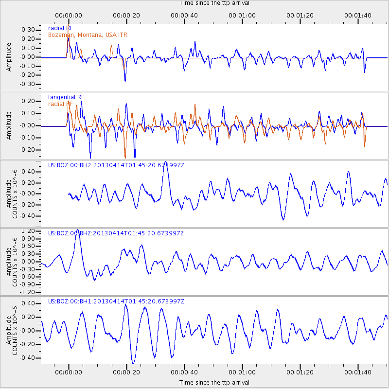
BOZ Bozeman, Montana, USA - Earthquake Result Viewer
*The percent match for this event was below the threshold and hence no stack was calculated.
| Earthquake location: |
Solomon Islands |
| Earthquake latitude/longitude: |
-6.5/154.6 |
| Earthquake time(UTC): |
2013/04/14 (104) 01:32:22 GMT |
| Earthquake Depth: |
31 km |
| Earthquake Magnitude: |
6.5 MW, 6.0 MB, 6.5 MS, 6.6 MW |
| Earthquake Catalog/Contributor: |
NEIC PDE/NEIC PDE-W |
|
| Network: |
US United States National Seismic Network |
| Station: |
BOZ Bozeman, Montana, USA |
| Lat/Lon: |
45.65 N/111.63 W |
| Elevation: |
1589 m |
|
| Distance: |
97.2 deg |
| Az: |
44.874 deg |
| Baz: |
268.146 deg |
| Ray Param: |
$rayparam |
*The percent match for this event was below the threshold and hence was not used in the summary stack. |
|
| Radial Match: |
68.97334 % |
| Radial Bump: |
395 |
| Transverse Match: |
72.920364 % |
| Transverse Bump: |
376 |
| SOD ConfigId: |
512894 |
| Insert Time: |
2013-09-13 06:46:03.720 +0000 |
| GWidth: |
2.5 |
| Max Bumps: |
400 |
| Tol: |
0.001 |
|
Signal To Noise
| Channel | StoN | STA | LTA |
| US:BOZ:00:BHZ:20130414T01:45:20.673997Z | 4.4148326 | 7.129916E-7 | 1.6149912E-7 |
| US:BOZ:00:BH1:20130414T01:45:20.673997Z | 1.6282511 | 1.6980916E-7 | 1.0428929E-7 |
| US:BOZ:00:BH2:20130414T01:45:20.673997Z | 3.0309575 | 3.174282E-7 | 1.0472869E-7 |
| Arrivals |
| Ps | |
| PpPs | |
| PsPs/PpSs | |


