You are here: Home > Network List > UW - Pacific Northwest Regional Seismic Network Stations List
> Station MRBL Marblemount, WA, USA > Earthquake Result Viewer
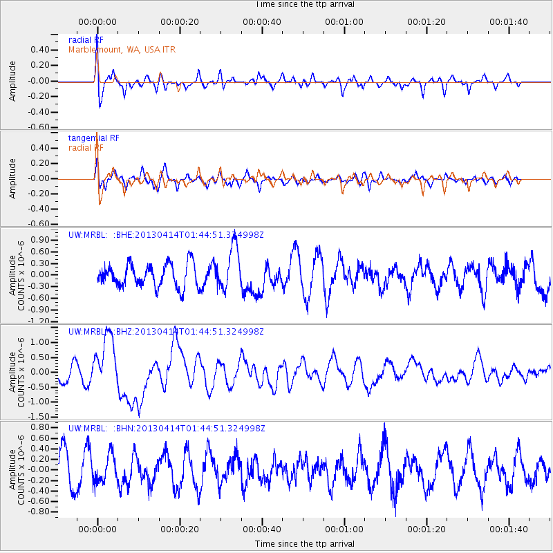
MRBL Marblemount, WA, USA - Earthquake Result Viewer
*The percent match for this event was below the threshold and hence no stack was calculated.
| Earthquake location: |
Solomon Islands |
| Earthquake latitude/longitude: |
-6.5/154.6 |
| Earthquake time(UTC): |
2013/04/14 (104) 01:32:22 GMT |
| Earthquake Depth: |
31 km |
| Earthquake Magnitude: |
6.5 MW, 6.0 MB, 6.5 MS, 6.6 MW |
| Earthquake Catalog/Contributor: |
NEIC PDE/NEIC PDE-W |
|
| Network: |
UW Pacific Northwest Regional Seismic Network |
| Station: |
MRBL Marblemount, WA, USA |
| Lat/Lon: |
48.52 N/121.48 W |
| Elevation: |
75 m |
|
| Distance: |
90.8 deg |
| Az: |
41.39 deg |
| Baz: |
261.184 deg |
| Ray Param: |
$rayparam |
*The percent match for this event was below the threshold and hence was not used in the summary stack. |
|
| Radial Match: |
57.58015 % |
| Radial Bump: |
400 |
| Transverse Match: |
67.30051 % |
| Transverse Bump: |
400 |
| SOD ConfigId: |
512894 |
| Insert Time: |
2013-09-13 06:48:54.517 +0000 |
| GWidth: |
2.5 |
| Max Bumps: |
400 |
| Tol: |
0.001 |
|
Signal To Noise
| Channel | StoN | STA | LTA |
| UW:MRBL: :BHZ:20130414T01:44:51.324998Z | 3.5581615 | 9.171577E-7 | 2.5776168E-7 |
| UW:MRBL: :BHN:20130414T01:44:51.324998Z | 0.98789126 | 2.57699E-7 | 2.608577E-7 |
| UW:MRBL: :BHE:20130414T01:44:51.324998Z | 1.9243622 | 5.672991E-7 | 2.947985E-7 |
| Arrivals |
| Ps | |
| PpPs | |
| PsPs/PpSs | |


