You are here: Home > Network List > AK - Alaska Regional Network Stations List
> Station MDM Murphy Dome > Earthquake Result Viewer
MDM Murphy Dome - Earthquake Result Viewer

| Earthquake location: |
Southern Iran |
| Earthquake latitude/longitude: |
28.0/62.0 |
| Earthquake time(UTC): |
2013/04/16 (106) 10:44:20 GMT |
| Earthquake Depth: |
80 km |
| Earthquake Magnitude: |
7.7 MW, 7.0 MB, 7.7 MW |
| Earthquake Catalog/Contributor: |
NEIC PDE/NEIC PDE-W |
|
| Network: |
AK Alaska Regional Network |
| Station: |
MDM Murphy Dome |
| Lat/Lon: |
64.96 N/148.23 W |
| Elevation: |
634 m |
|
| Distance: |
84.4 deg |
| Az: |
12.432 deg |
| Baz: |
333.439 deg |
| Ray Param: |
0.045362905 |
| Estimated Moho Depth: |
37.5 km |
| Estimated Crust Vp/Vs: |
2.10 |
| Assumed Crust Vp: |
6.566 km/s |
| Estimated Crust Vs: |
3.13 km/s |
| Estimated Crust Poisson's Ratio: |
0.35 |
|
| Radial Match: |
95.47232 % |
| Radial Bump: |
400 |
| Transverse Match: |
90.30387 % |
| Transverse Bump: |
400 |
| SOD ConfigId: |
512894 |
| Insert Time: |
2013-09-13 07:12:35.523 +0000 |
| GWidth: |
2.5 |
| Max Bumps: |
400 |
| Tol: |
0.001 |
|
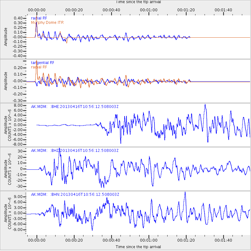
Signal To Noise
| Channel | StoN | STA | LTA |
| AK:MDM: :BHZ:20130416T10:56:12.508003Z | 12.488308 | 2.0537616E-6 | 1.6445475E-7 |
| AK:MDM: :BHN:20130416T10:56:12.508003Z | 2.7565882 | 4.017269E-7 | 1.4573338E-7 |
| AK:MDM: :BHE:20130416T10:56:12.508003Z | 2.6545434 | 3.939017E-7 | 1.4838774E-7 |
| Arrivals |
| Ps | 6.4 SECOND |
| PpPs | 17 SECOND |
| PsPs/PpSs | 24 SECOND |


