You are here: Home > Network List > GS - US Geological Survey Networks Stations List
> Station KAN10 Keim Farm > Earthquake Result Viewer
KAN10 Keim Farm - Earthquake Result Viewer
*The percent match for this event was below the threshold and hence no stack was calculated.
| Earthquake location: |
Kuril Islands |
| Earthquake latitude/longitude: |
46.6/152.6 |
| Earthquake time(UTC): |
2014/07/18 (199) 18:13:49 GMT |
| Earthquake Depth: |
0.0 km |
| Earthquake Magnitude: |
4.7 mb, 3.8 ML, 3.6 mbtmp, 3.4 mb1mx, 3.7 mb1, 3.6 mb |
| Earthquake Catalog/Contributor: |
ISC/ISC |
|
| Network: |
GS US Geological Survey Networks |
| Station: |
KAN10 Keim Farm |
| Lat/Lon: |
37.12 N/98.10 W |
| Elevation: |
417 m |
|
| Distance: |
75.3 deg |
| Az: |
51.227 deg |
| Baz: |
317.76 deg |
| Ray Param: |
$rayparam |
*The percent match for this event was below the threshold and hence was not used in the summary stack. |
|
| Radial Match: |
56.793507 % |
| Radial Bump: |
382 |
| Transverse Match: |
74.48263 % |
| Transverse Bump: |
400 |
| SOD ConfigId: |
3390531 |
| Insert Time: |
2019-04-12 22:34:54.449 +0000 |
| GWidth: |
2.5 |
| Max Bumps: |
400 |
| Tol: |
0.001 |
|
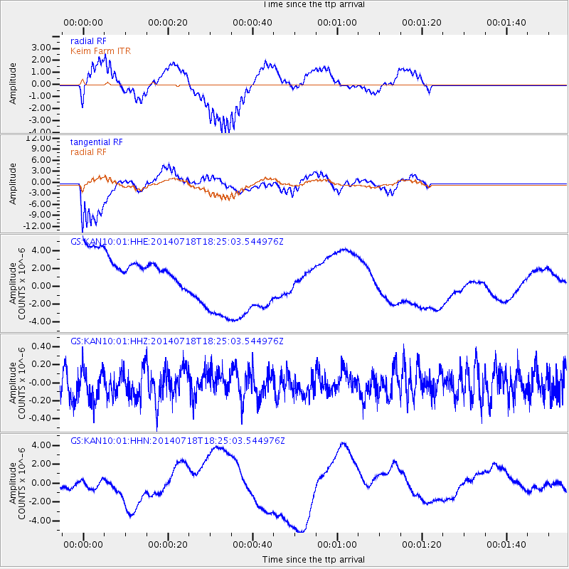
Signal To Noise
| Channel | StoN | STA | LTA |
| GS:KAN10:01:HHZ:20140718T18:25:03.544976Z | 1.2306374 | 1.8085164E-7 | 1.4695769E-7 |
| GS:KAN10:01:HHN:20140718T18:25:03.544976Z | 0.44929743 | 6.140079E-7 | 1.3665956E-6 |
| GS:KAN10:01:HHE:20140718T18:25:03.544976Z | 3.9045851 | 5.56121E-6 | 1.4242767E-6 |
| Arrivals |
| Ps | |
| PpPs | |
| PsPs/PpSs | |


