You are here: Home > Network List > TA - USArray Transportable Network (new EarthScope stations) Stations List
> Station V60A Jim Taylor Road, Stokes, NC, USA > Earthquake Result Viewer
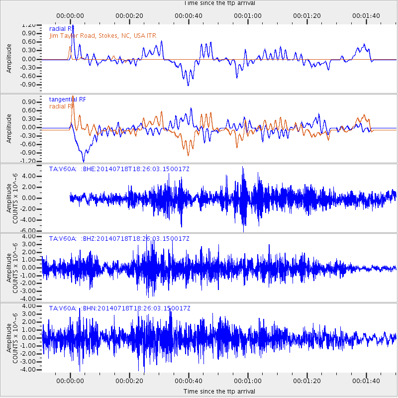
V60A Jim Taylor Road, Stokes, NC, USA - Earthquake Result Viewer
*The percent match for this event was below the threshold and hence no stack was calculated.
| Earthquake location: |
Kuril Islands |
| Earthquake latitude/longitude: |
46.6/152.6 |
| Earthquake time(UTC): |
2014/07/18 (199) 18:13:49 GMT |
| Earthquake Depth: |
0.0 km |
| Earthquake Magnitude: |
4.7 mb, 3.8 ML, 3.6 mbtmp, 3.4 mb1mx, 3.7 mb1, 3.6 mb |
| Earthquake Catalog/Contributor: |
ISC/ISC |
|
| Network: |
TA USArray Transportable Network (new EarthScope stations) |
| Station: |
V60A Jim Taylor Road, Stokes, NC, USA |
| Lat/Lon: |
35.76 N/77.26 W |
| Elevation: |
8.0 m |
|
| Distance: |
86.6 deg |
| Az: |
38.512 deg |
| Baz: |
328.152 deg |
| Ray Param: |
$rayparam |
*The percent match for this event was below the threshold and hence was not used in the summary stack. |
|
| Radial Match: |
50.47197 % |
| Radial Bump: |
400 |
| Transverse Match: |
38.94358 % |
| Transverse Bump: |
400 |
| SOD ConfigId: |
3390531 |
| Insert Time: |
2019-04-12 22:38:26.779 +0000 |
| GWidth: |
2.5 |
| Max Bumps: |
400 |
| Tol: |
0.001 |
|
Signal To Noise
| Channel | StoN | STA | LTA |
| TA:V60A: :BHZ:20140718T18:26:03.150017Z | 1.6506095 | 8.543188E-7 | 5.1757775E-7 |
| TA:V60A: :BHN:20140718T18:26:03.150017Z | 1.8254148 | 1.3584477E-6 | 7.4418574E-7 |
| TA:V60A: :BHE:20140718T18:26:03.150017Z | 2.6435773 | 1.6847196E-6 | 6.372878E-7 |
| Arrivals |
| Ps | |
| PpPs | |
| PsPs/PpSs | |


