You are here: Home > Network List > US - United States National Seismic Network Stations List
> Station MIAR Mount Ida, Arkansas, USA > Earthquake Result Viewer
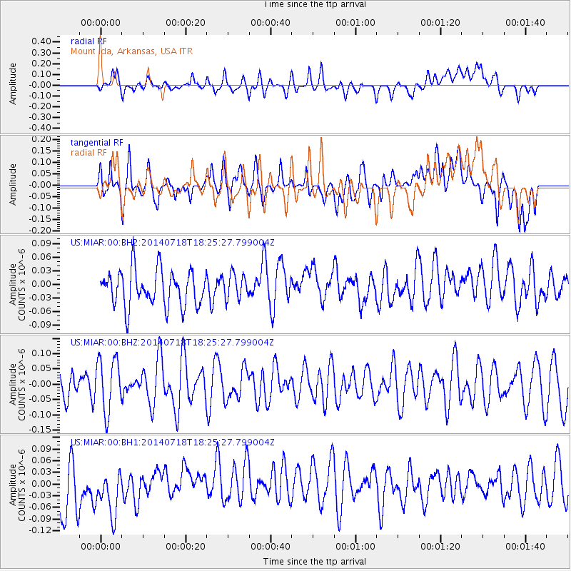
MIAR Mount Ida, Arkansas, USA - Earthquake Result Viewer
*The percent match for this event was below the threshold and hence no stack was calculated.
| Earthquake location: |
Kuril Islands |
| Earthquake latitude/longitude: |
46.6/152.6 |
| Earthquake time(UTC): |
2014/07/18 (199) 18:13:49 GMT |
| Earthquake Depth: |
0.0 km |
| Earthquake Magnitude: |
4.7 mb, 3.8 ML, 3.6 mbtmp, 3.4 mb1mx, 3.7 mb1, 3.6 mb |
| Earthquake Catalog/Contributor: |
ISC/ISC |
|
| Network: |
US United States National Seismic Network |
| Station: |
MIAR Mount Ida, Arkansas, USA |
| Lat/Lon: |
34.55 N/93.58 W |
| Elevation: |
207 m |
|
| Distance: |
79.7 deg |
| Az: |
50.12 deg |
| Baz: |
320.156 deg |
| Ray Param: |
$rayparam |
*The percent match for this event was below the threshold and hence was not used in the summary stack. |
|
| Radial Match: |
37.93494 % |
| Radial Bump: |
400 |
| Transverse Match: |
42.58357 % |
| Transverse Bump: |
400 |
| SOD ConfigId: |
3390531 |
| Insert Time: |
2019-04-12 22:39:03.926 +0000 |
| GWidth: |
2.5 |
| Max Bumps: |
400 |
| Tol: |
0.001 |
|
Signal To Noise
| Channel | StoN | STA | LTA |
| US:MIAR:00:BHZ:20140718T18:25:27.799004Z | 1.7764128 | 8.865883E-8 | 4.9908913E-8 |
| US:MIAR:00:BH1:20140718T18:25:27.799004Z | 1.124553 | 6.340419E-8 | 5.6381683E-8 |
| US:MIAR:00:BH2:20140718T18:25:27.799004Z | 0.6967863 | 2.791332E-8 | 4.006009E-8 |
| Arrivals |
| Ps | |
| PpPs | |
| PsPs/PpSs | |


