
HEH Heihe,Heilongjiang Province - Earthquake Result Viewer
| ||||||||||||||||||
| ||||||||||||||||||
| ||||||||||||||||||
|
Signal To Noise
| Channel | StoN | STA | LTA |
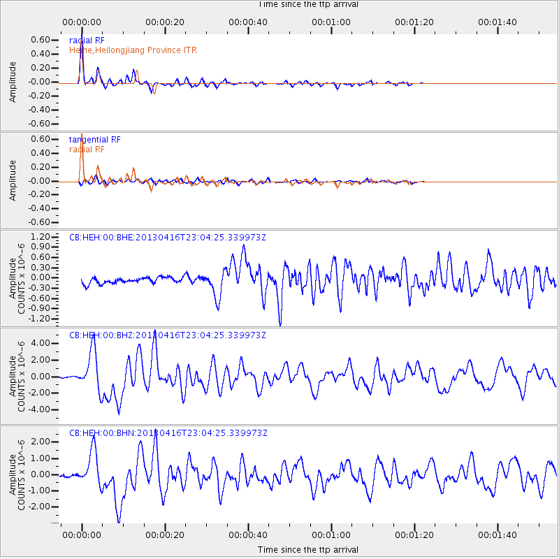
| CB:HEH:00:BHZ:20130416T23:04:25.339973Z | 24.195568 | 2.4701756E-6 | 1.02092066E-7 |
| CB:HEH:00:BHN:20130416T23:04:25.339973Z | 13.45939 | 1.0979614E-6 | 8.157587E-8 |
| CB:HEH:00:BHE:20130416T23:04:25.339973Z | 4.514601 | 3.9101917E-7 | 8.6612125E-8 |
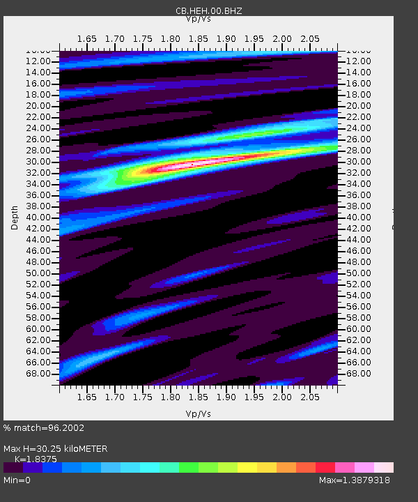
| Arrivals | |
| Ps | 4.2 SECOND |
| PpPs | 13 SECOND |
| PsPs/PpSs | 17 SECOND |

